Steep Scotland
This site uses cookies to help understand how you and other visitors use the site. You can see a list of these cookies, and what they are used for, on the cookie information page.

By visiting any other page on this website, you are consenting to the use of cookies by this site. You will only see this message once, but will be able to set your preference at any time on the cookie information page.

Liathach: Coire Na Caime

Liathach: Coire Na Caime.   Photo: Scott Muir

A vast corrie consisting of several distinct areas, offering a mixture of graded gullies and big steep slopes, on different aspects.

Approach:

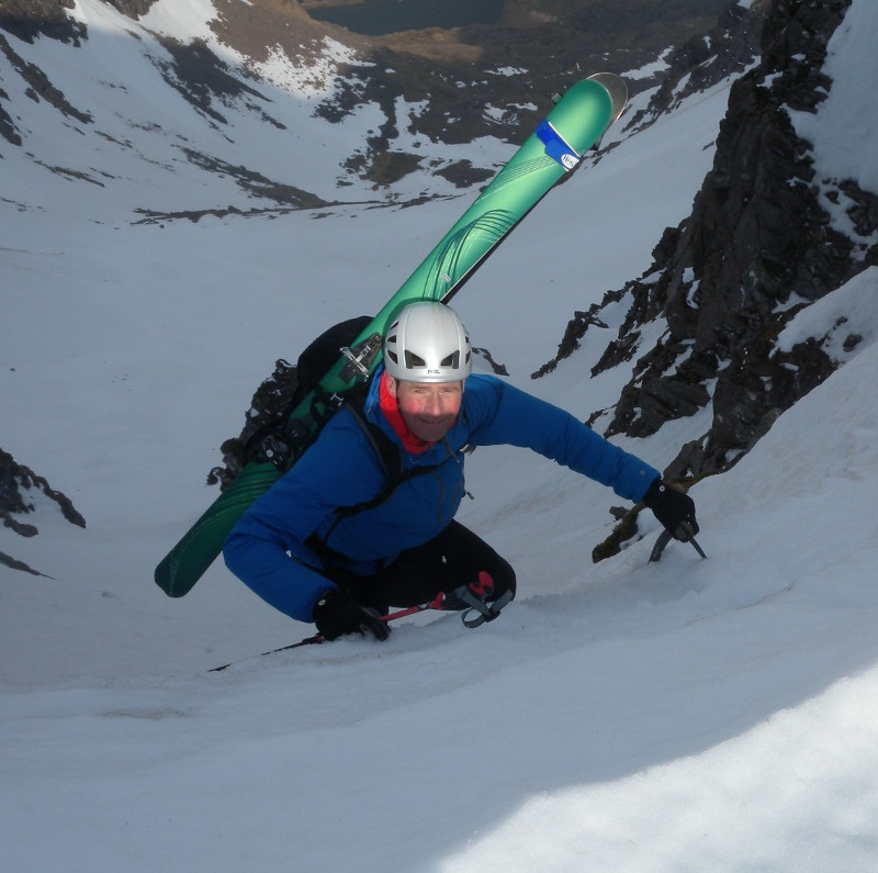
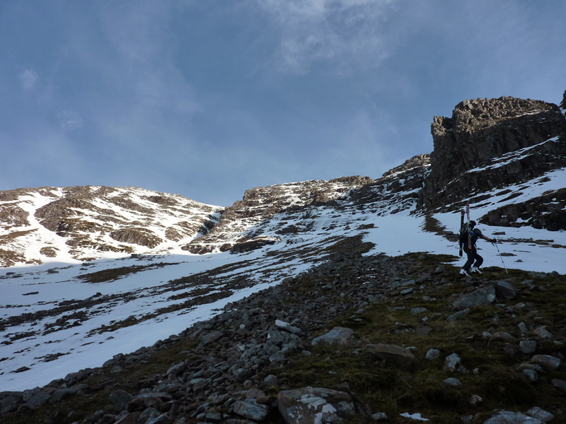
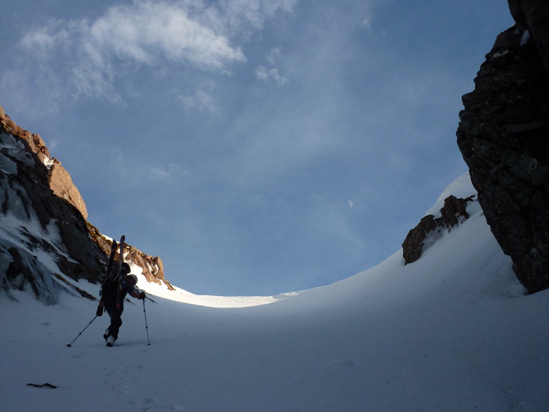
As with Coire Dubh Beag and Coire Dubh Mor, the best option is to park at the Coire Dubh car park (NG 957 568), and follow the excellent path up the glen to the watershed.  If you have reached the point where the path forks (the left fork heads west down the glen between Liathach and Beinn Dearg - the right fork skirts the base of Sail Mhor and ends up in Coire Mhic Fhearchair on Beinn Eighe), then you have gone a little too far.   From the highpoint of the path, you need to skirt below both Coire Dubh Beag and Coire Dubh Mor.  It is best to aim to pass below a small prominent flat topped nose of rock, which is located below the buttress between Coire Dubh Beag and Coire Dubh Mor. Without snowcover, the ground is rough with heather and bouldery hollows, but doesn't take too long - about 2hrs 30 minutes to the bottom of Am Fasarinen, for example. 

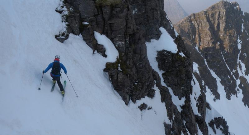
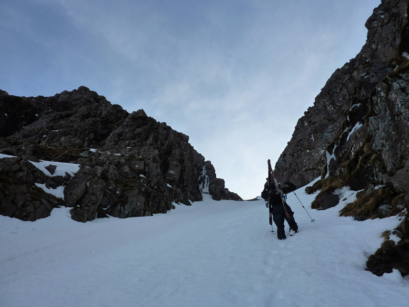
If you are aiming for the Am Fasarinen side of the corrie, it is advisable to traverse the west facing slope of Spidean a' Choire Leith (assuming snow conditions allow), aiming for the left hand side of the large obvious mass of boulders below the cliff.  It's best avoided if you can help it!

Orientation:

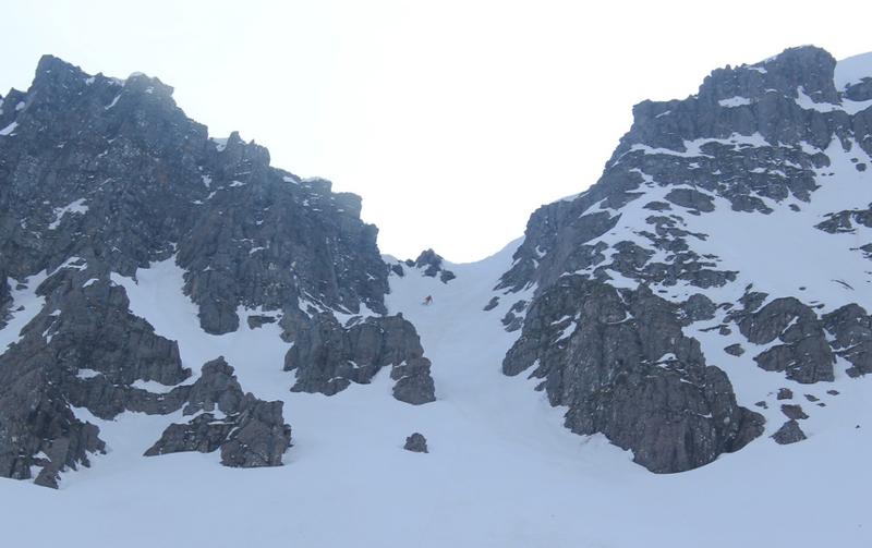
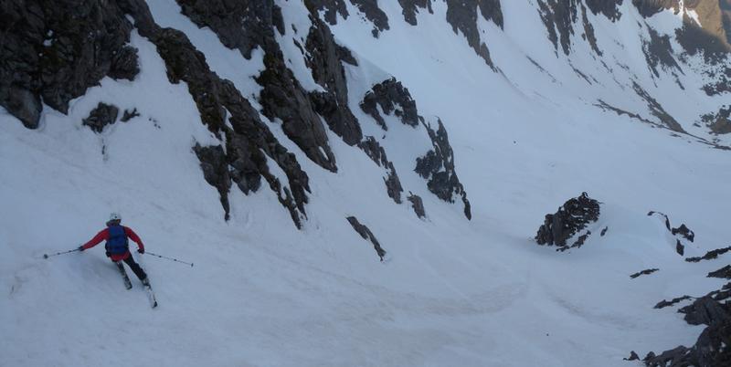
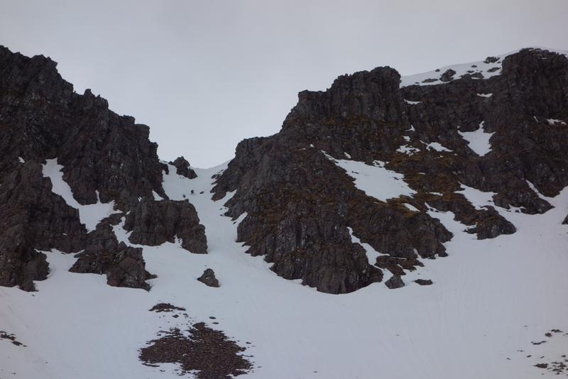
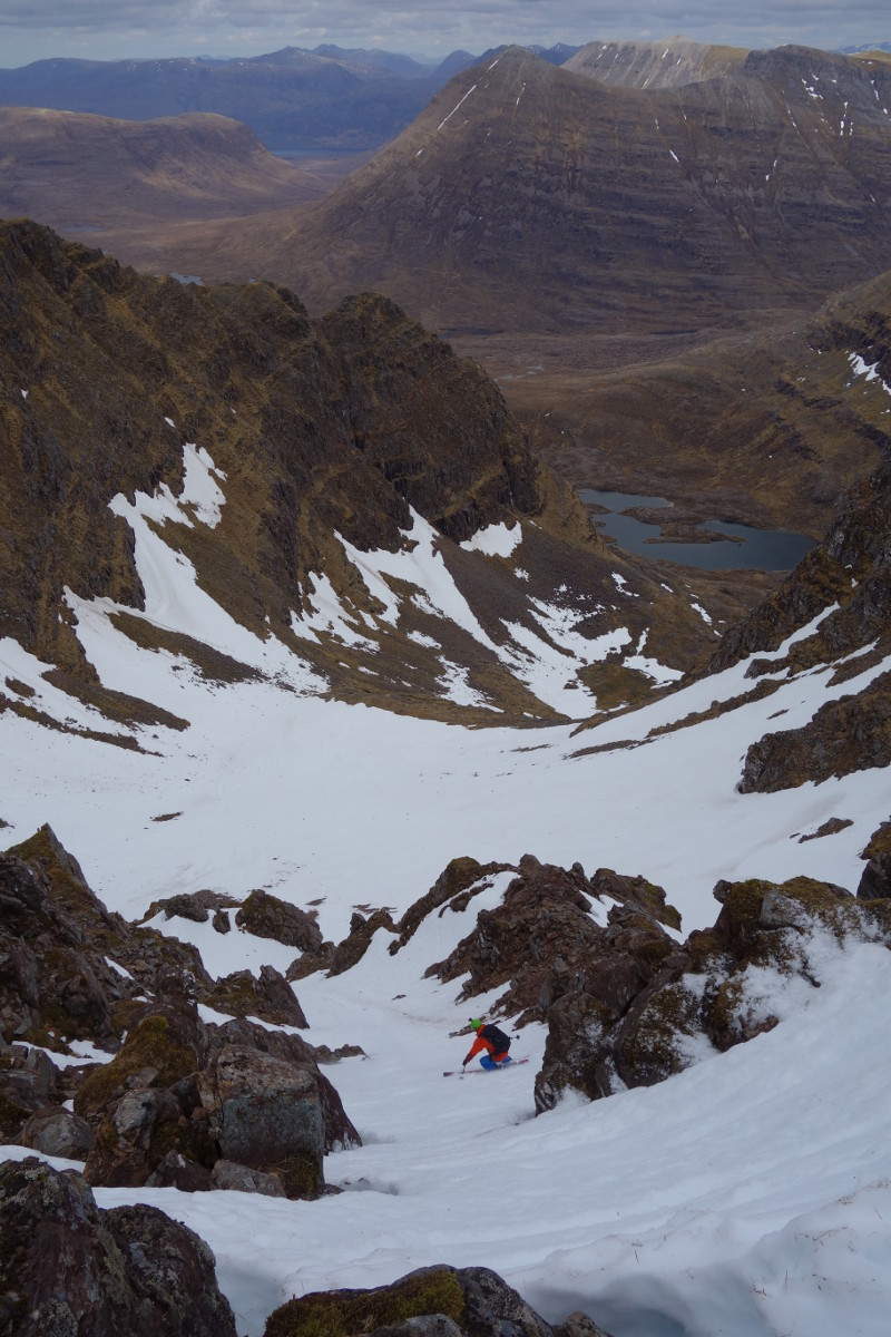
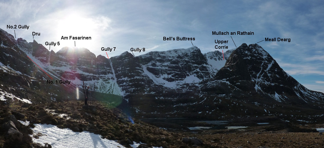
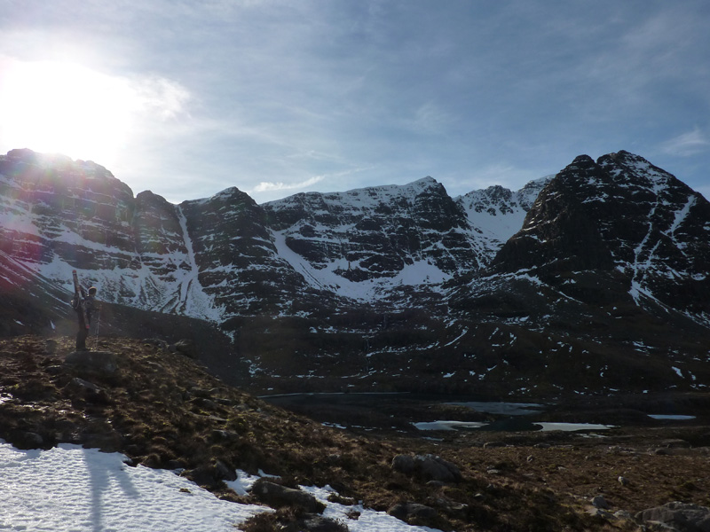
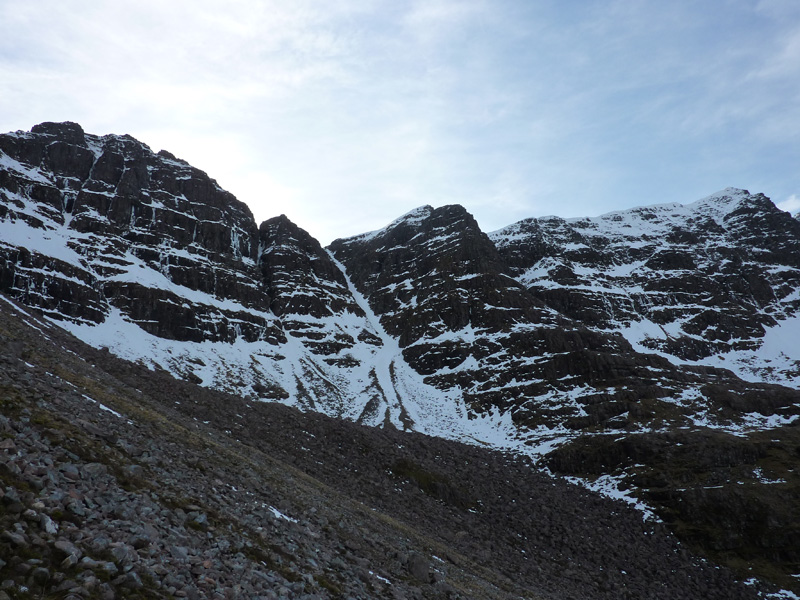
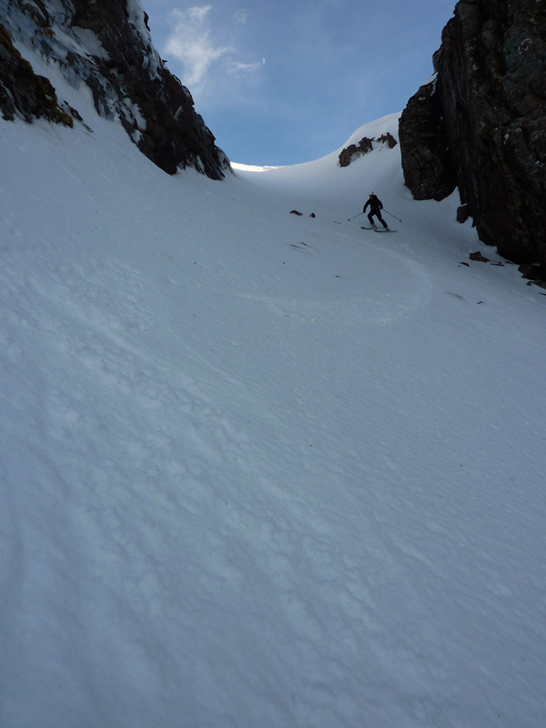
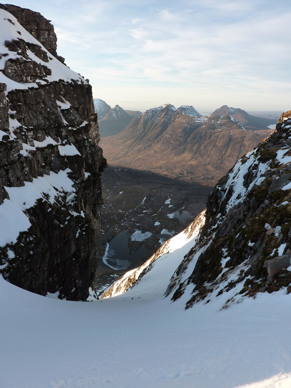
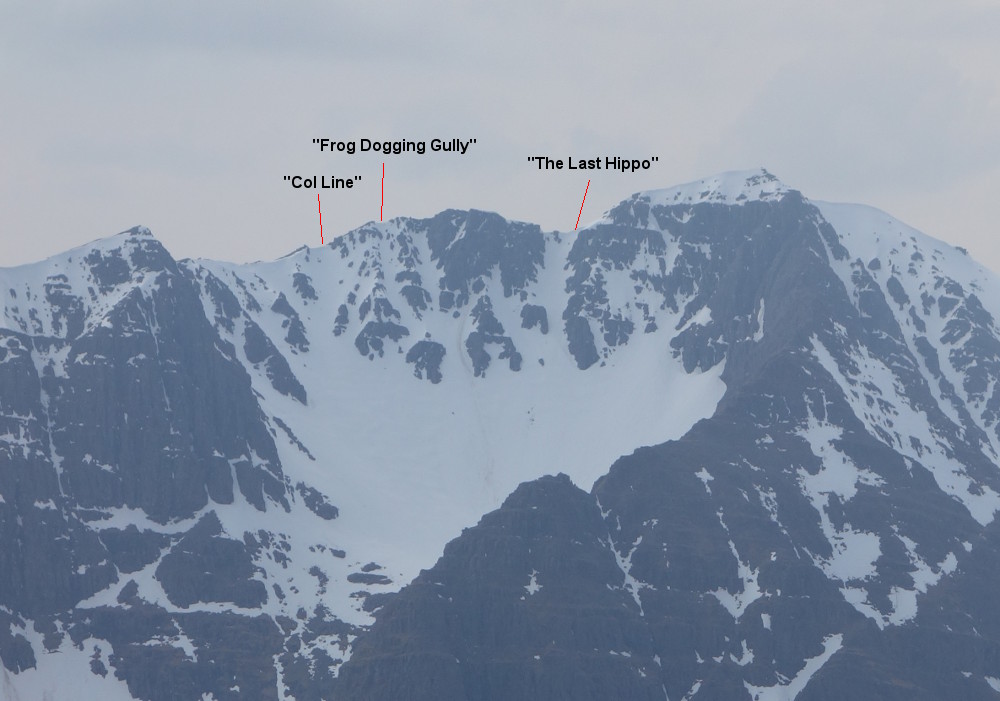
The corrie is wide and has several distinct sections.  On the left (East), is Spidean a' Choire Leith, and the ridge to the west is Am Fasarinen, a complex section of the ridge that involves some easy technical climbing to traverse.  Near the left hand side is the prominent left leaning triangle of rock, known as "The Dru".  Several gullies drop from the ridge.  Am Fasarinen is bounded on the right hand side by a terraced buttress than drops low into the corrie from the spot height 903m. The buttress has grade I gullies descending either side of it (Gully 7 and Gully 8).  Gully 7 is the wide, straight, most obvious gully in the corrie.

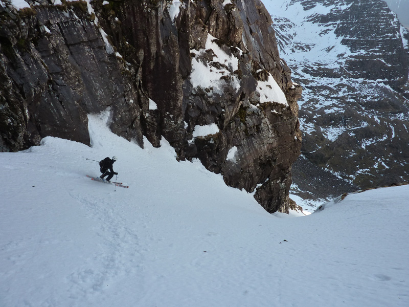
To the right of the terraced buttress, is the upper corrie below Mullach an Rathain.  A large buttress (Bells Buttress) gives way to big slopes below the summit.  This side of the corrie curves round, with another section of technical ridge, the northern pinnacles of Meall Dearg.  There are some short gullies descending from high up on the ridge.  

Other possibilities:

I haven't done these yet, but they will hopefully get investigated as some point.

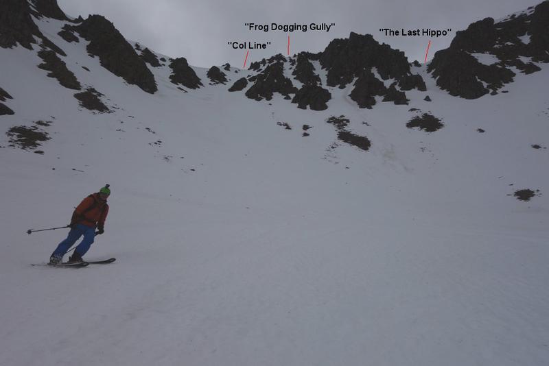
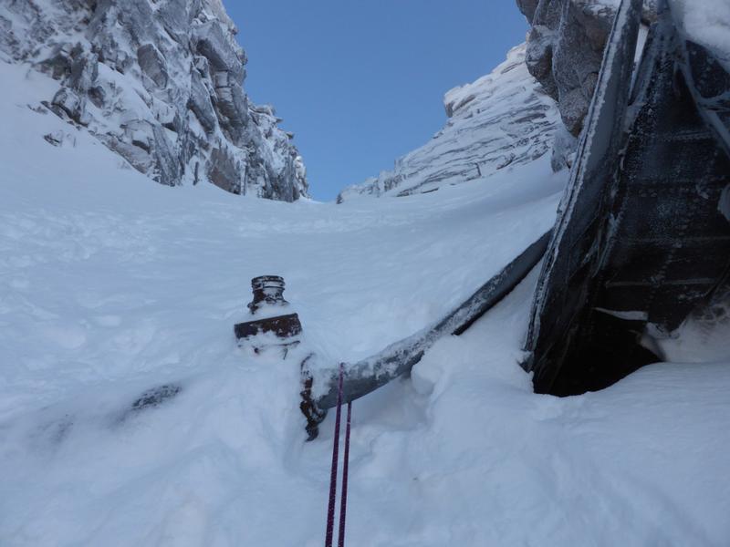
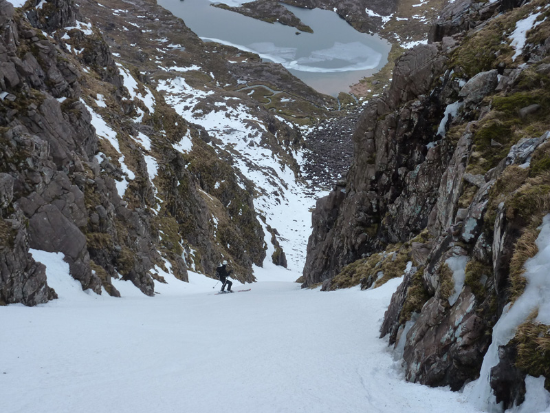
  • The slanting line of No. 2 Gully looks perfectly skiable,  It cuts across the cliff towards the base of No. 1 Gully.  It starts out as a gully, then becomes a ramp line above an icy slab - not a place to have a fall.
  • Gully 5.  This short Grade I is located to the West of the prominent pinnacle, nicknamed "The Dru".
  • Gully 8.  I haven't looked into the top of this yet, but the upper gully looks short, followed by a big slope into the west side of the corrie.  Looks good.

Relevant Weather Forecasts

Met Office Logo
MWIS Logo
Mountain-forecast.com Logo

Gully 7 is the obvious straight gully line that you see as you round the corner of the corrie from the East.  It is just left of a prominent buttress, the top of which is marked as a spot height of 903m on OS 1:50000 maps.  The gully is wide and straight, and fairly uniform in gradient.  The very top of the gully may be rubble, preventing a complete descent from the ridge, but that aside, it is definitely worth doing. 

Gully 7 is the obvious straight gully line on the left hand side.  Photo: Scott Muir
Descending Gully 7  Photo: Scott Muir
Gully 7  Photo: Scott Muir
Heading up Gully 7  Photo: Scott Muir
Grid Reference: NG922574

Approximate Start Height: 870m

Approximate Descent: 200m

General Aspect: North

Climbing Grade: I

Notes: Wide and straighforward
 

Tucked high up on the East side of Coire Na Caime, No.1 Gully is a short, but wide corridor that sits above a large West facing slope.  It is hidden on the approach from the East until you are below it.  The gully leads to a small col just to the West of Spidean a' Choire Leith. The descent is quite straightforward, being wide and of fairly uniform gradient.  It is however, a stunning ski, as you have an amazing outlook over the lochan way below to Beinn Alligin and Beinn Dearg.

In lean conditions, an area of boulders may sit bare in the middle of the upper section of the gully.

Looking back up to No. 1 Gully  Photo: Scott Muir
Ascending No. 1 Gully  Photo: Scott Muir
Descending the top section of No. 1 Gully  Photo: Scott Muir
Getting the turns in, on No. 1 Gully.  Photo: Scott Muir
Heading for No. 1 Gully, up on the left.  Photo: Scott Muir
Looking down No. 1 Gully from the ridge.  Photo: Scott Muir
Near the top of the ascent of No. 1 Gully  Photo: Scott Muir
Grid Reference: NG927577

Approximate Start Height: 940m

Approximate Descent: 250m

General Aspect: WNW

Climbing Grade: I

Notes: Easy for Grade I
 

The Westernmost lobe of Coire na Caime has multiple possible descent options.  Rather than detail them all individually, 3 lines are described.

The most obvious gully line, and the one detailed here starts from the first obvious col to the East of the summit of Mullach an Rathain.  The initial 100m (approximately) of the descent is in a shallow gully before opening up into the corrie floor.  Steeper than No. 1 Gully and Gully 7, it gives a great long ski.  This was given the name "The Last Hippo" (not by me!) after an earlier descent than mine, with no explanation provided...

Towards the col, there are several more amenable lines, and the build up of snow will determine what looks best, but the line marked "Col Line" holds the most snow and is a pleasant ski.

Between the 2 are a couple of steep narrow lines.  The line nearest Mullach an Rathain is capped by a vertical wall of rock, but the shallower line to the East is possible from the ridge.  Depending on build up, it will be very narrow, and has an escape into the main bowl (skiers right).  This was named "Frog Dogging Gully" (not by me either!) after a descent in April 2018, due to considerable amphibious activity observed just below the snow line...

The upper corrie holds snow well, so this is a relatively reliable location to ski, even late in the season.

Looking into the upper corrie, with the obvious descent lines marked.  Photo: Scott Muir
An alternative steeper entry into the gully of 'The Last Hippo'  Photo: Andy Inglis
Andy Inglis descending 'The Last Hippo'  Photo: Graeme Gatherer
Climbing up to the col.  Photo: Andy Inglis
Looking down the gully line of 'The Last Hippo' from the col  Photo: Andy Inglis
The upper gully ('The Last Hippo')  Photo: Andy Inglis
Dave Anderson skiing the gully line of 'The Last Hippo'  Photo: Scott Muir
Neil Fleming in 'Frog Dogging Gully', 21st of April 2018  Photo: Scott Muir
The view from the corrie floor  Photo: Scott Muir
Grid Reference: NG914576

Approximate Start Height: 950m

Approximate Descent: 300m

General Aspect: North

Climbing Grade: I

Notes: Grade I ground for the first 100m of vertical, then eases.
 
Bookmark and Share
Mountain List
 
Latest News
Map updates
Updates to the mapping functionality
16-Oct-21
Overdue site content updates!
New pages and updates to the site, including Gleann Eanaich, Bla Bheinn and Beinn Alligin
07-Apr-21
 
 
Random Image
Site developed by Scott Muir
Site News   |   Disclaimer   |   Accessibility   |   Site Map   |   Cookie Information  
© Steep Scotland 2024