Steep Scotland
This site uses cookies to help understand how you and other visitors use the site. You can see a list of these cookies, and what they are used for, on the cookie information page.

By visiting any other page on this website, you are consenting to the use of cookies by this site. You will only see this message once, but will be able to set your preference at any time on the cookie information page.

Beinn Alligin

Beinn Alligin.   Photo: Scott Muir

Beinn Alligin probably isn't a mountain that springs to mind when considering skiing, yet with the right conditions, as with any hill, there's something worthwhile to be found.  Beinn Alligin is home to one of the jewels in the crown as far as gully skiing goes in Scotland: Deep South Gully.

Approach

The excellent path into Coire Mhic Nòbuil allows for a quick approach.  Crossing the Abhainn Coire Mhic Nòbuil at NG882588, the path rises towards the Horns of Alligin.  Look for a small path to the right before the main path climbs steeply up onto the ridge at 350m (NG882602).  Follow the right branch (easy to lose at points), towards the Bealach a Chomhla between the Horns of Alligin and Beinn Dearg.  Deep South Gully is the first deep gully to pass below, hopefully with a tongue of snow protruding from the mouth of it.  Once you've had your fun, it's simply a case of retracing your steps back out, unless you decide to climb up and over Beinn Alligin for another ski (Coir nan Laogh possible).

Relevant Weather Forecasts

Met Office Logo
MWIS Logo
Mountain-forecast.com Logo

Relevant Avalanche Forecasts

There is one relevant Scottish Avalanche Information Service forecast for Beinn Alligin.

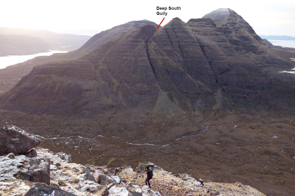
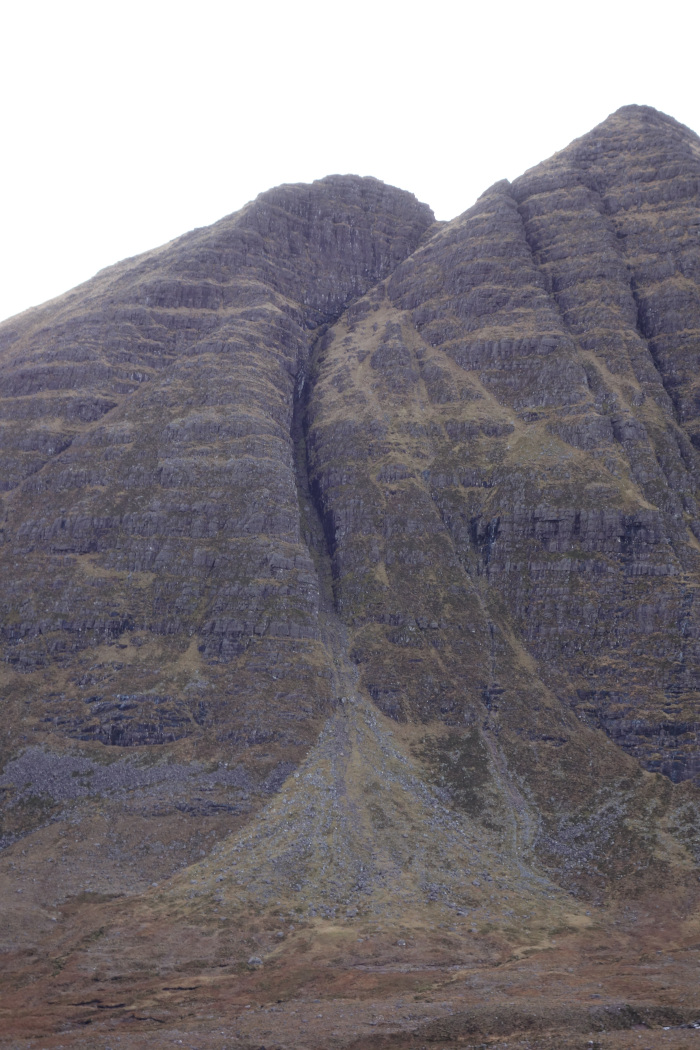
With stunning scenery and constant interest, Deep South Gully is regarded as one of the finest Grade I gullies in the country by climbers.  As a ski descent, it seems somewhat improbable. Located between the first and second of the Horns of Alligin, the top of the gully is just below 800m and isn't backed by any form of plateau to collect snow.  The advantage of this is that it's unlikely to ever have a troubling cornice, but the disadvantage is how infrequently it is possibly in condition to ski.  However, in April 2018, when the rest of the mountain was quite free of snow, the gully was complete and then some, allowing a vertical descent of 350m. 

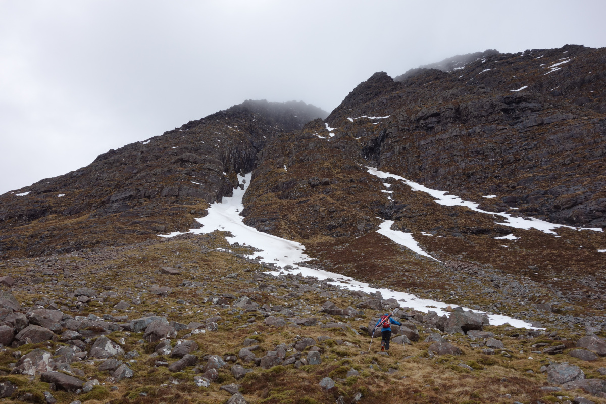
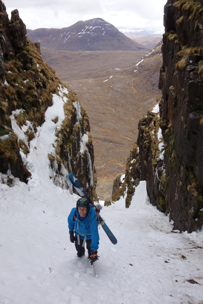
It's best to climb up the gully prior to a descent.  Partly because it is actually an easier approach than scrambling over the first of the Horns, but also it gives you an idea of what is coming.

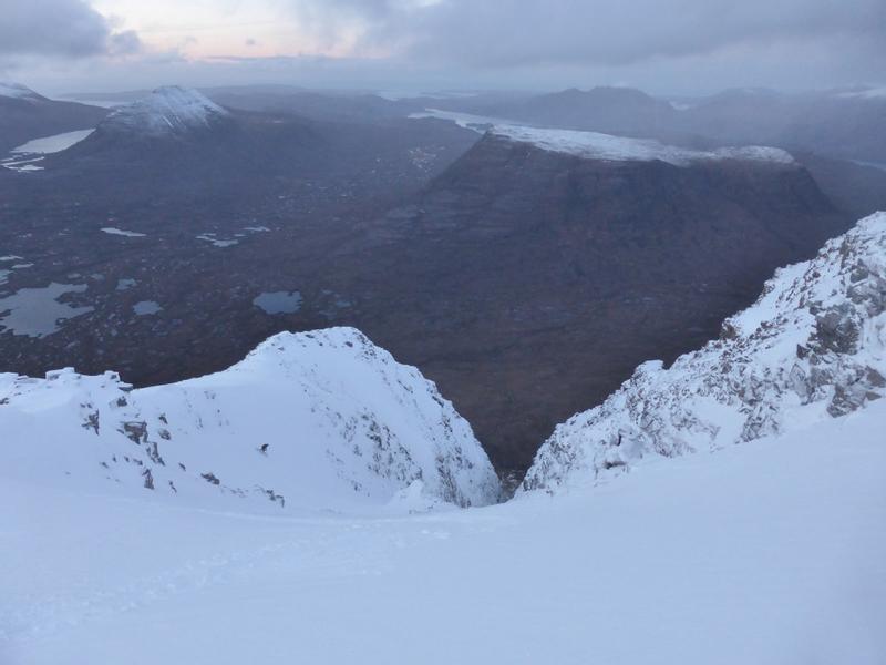
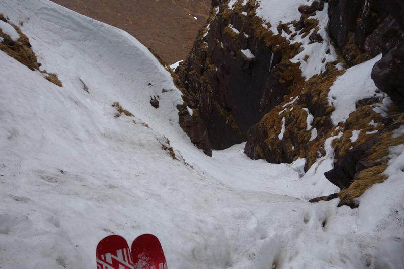
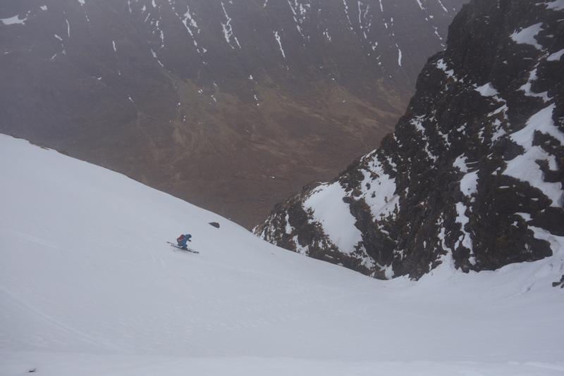
In descent, the gully starts from the col, with an open funnel shaped slope. giving you the chance to get a few warm up turns.  At the end of the introductory slope potentially comes your first difficulty.  A narrow section (possibly slightly icy) is to be negotiated.  A slight overhand in the opposite wall may give you some space to get turned around.  In 2018, there was a projecting lump of rock that appeared useful for holding onto to get turned around.  If it's still there, don't touch it: it moves!

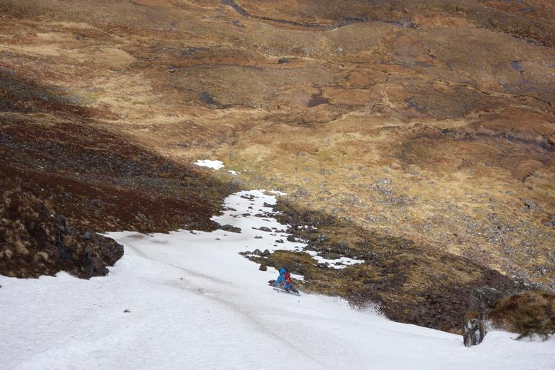
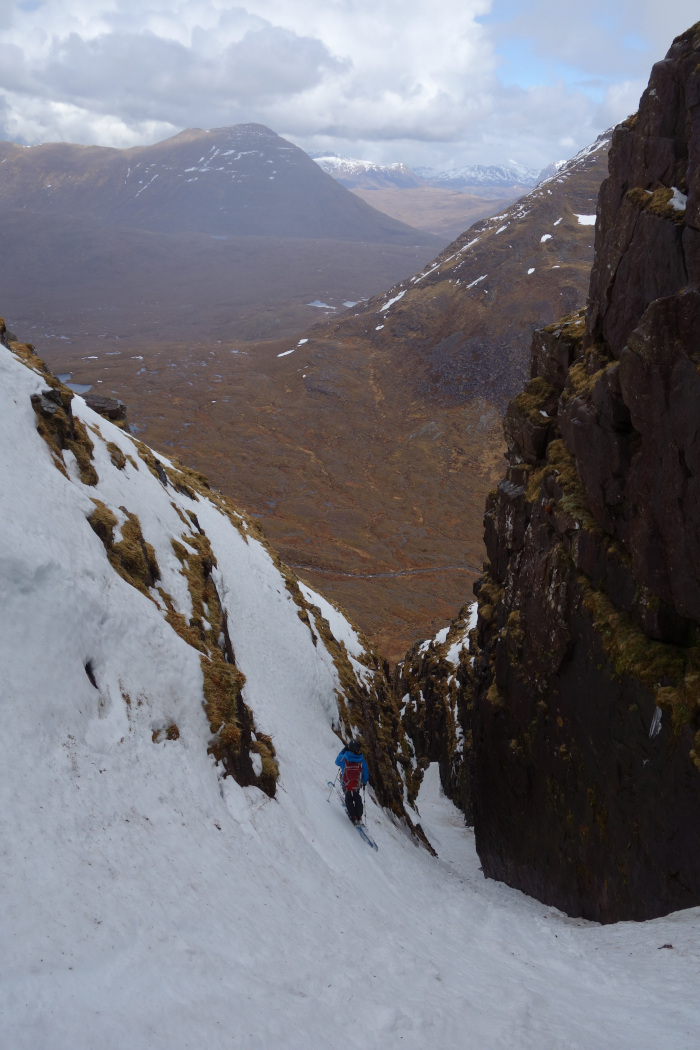
Once pointing the other way, the next obstacle is immediately below.  Round about here is a chockstone.  In April 2018. this was buried, but there was an awkward icy fringe to negotiate.  However, on skiers left, there was a handly little bypass avoiding this, that allowed you to return just below it.  A few wider turns below bring you to a narrower section.  The build up will determine how easy this is.  We were lucky, and were able to ski down it, but much less, and it could mean a downclimb.  Below this pinch point, the gully opens up, and is much more straightforward.

Heading for the tongue of snow extending out of the mouth of the gully  Photo: Scott Muir
A view of the gully without snow from the bealach  Photo: Scott Muir
Above the chockstone, with the bypass on the left  Photo: Scott Muir
Steve Clark climbing up the lower reaches of the gully  Photo: Scott Muir
Steve Clark following the very helpful tongue of snow out of the mouth of the gully  Photo: Scott Muir
Steve Clark relaxing in the lower gully, below all the difficult points  Photo: Scott Muir
The easy upper slope  Photo: Scott Muir
The narrow section below the chockstone  Photo: Scott Muir
Grid Reference: NG876612

Approximate Start Height: 790m

Approximate Descent: 350m

General Aspect: Northeast

Climbing Grade: I

Notes: At the upper end of the spectrum for Grade I
 
Bookmark and Share
Mountain List
 
Latest News
Map updates
Updates to the mapping functionality
16-Oct-21
Overdue site content updates!
New pages and updates to the site, including Gleann Eanaich, Bla Bheinn and Beinn Alligin
07-Apr-21
 
 
Random Image
Site developed by Scott Muir
Site News   |   Disclaimer   |   Accessibility   |   Site Map   |   Cookie Information  
© Steep Scotland 2024