Steep Scotland
This site uses cookies to help understand how you and other visitors use the site. You can see a list of these cookies, and what they are used for, on the cookie information page.

By visiting any other page on this website, you are consenting to the use of cookies by this site. You will only see this message once, but will be able to set your preference at any time on the cookie information page.

Corrie Fee, Mayar

Corrie Fee, Mayar.   Photo: Scott Muir

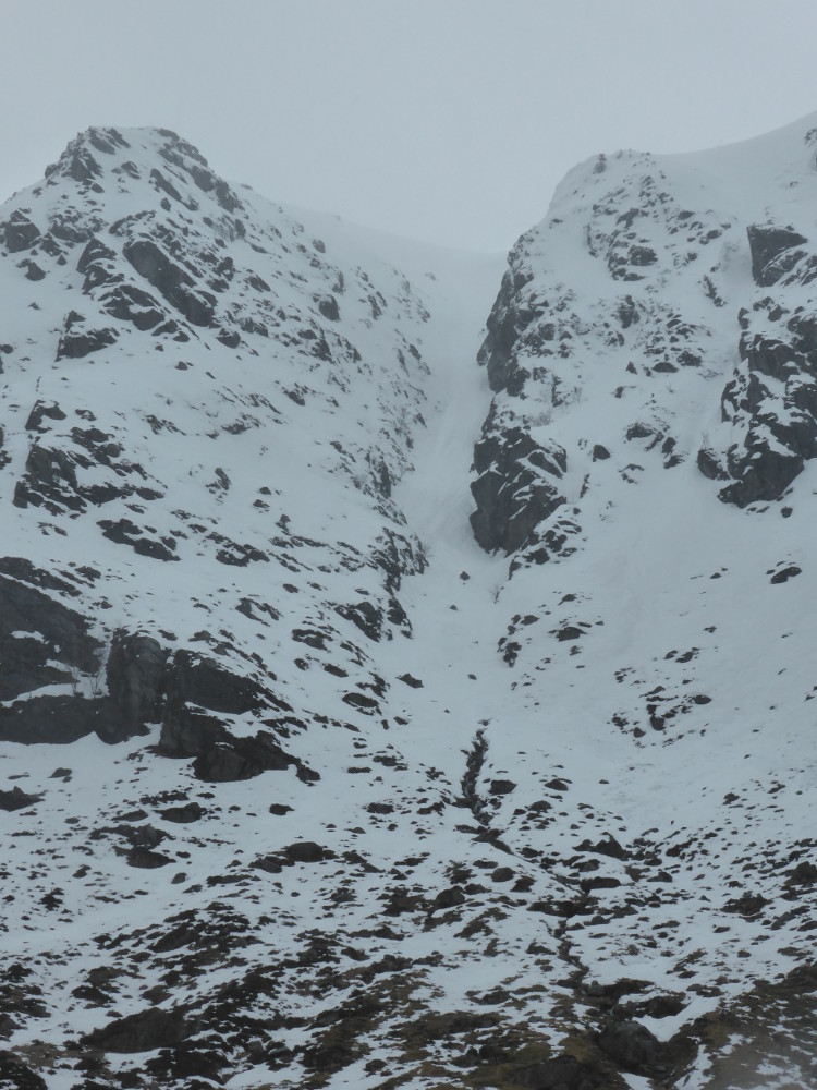
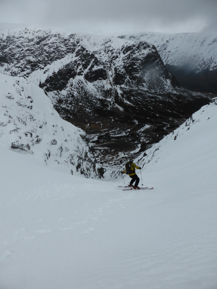
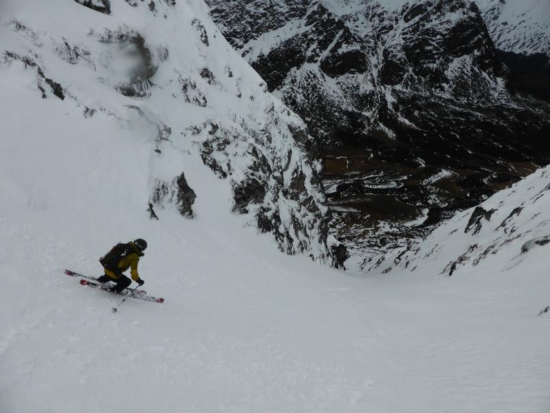
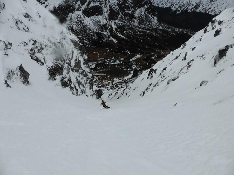
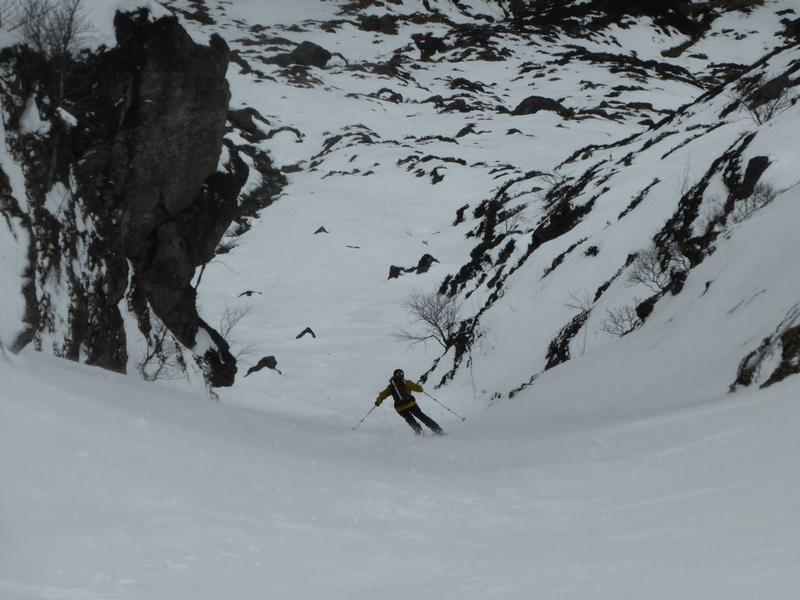
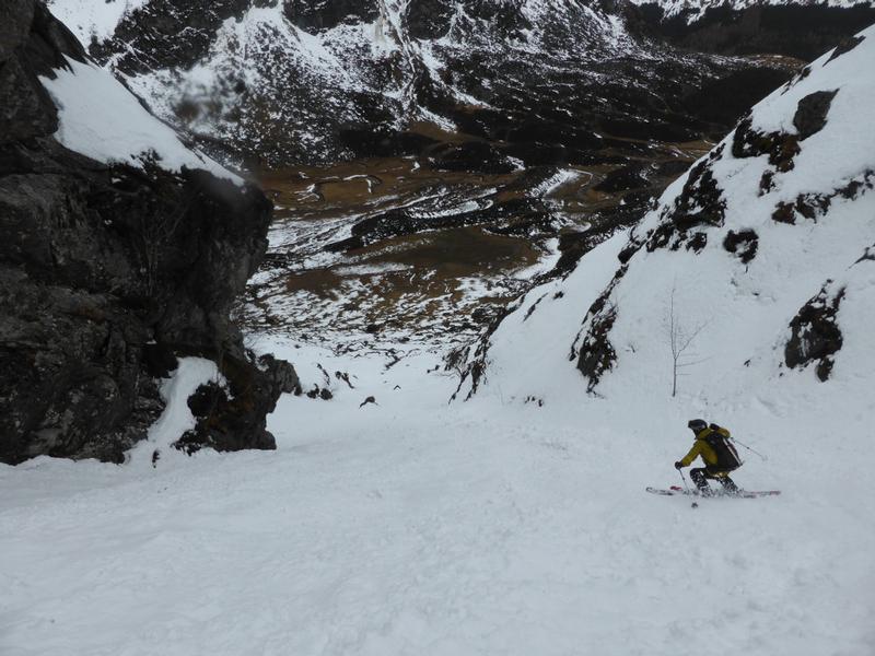
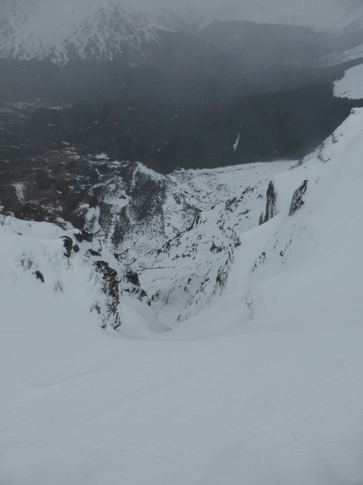
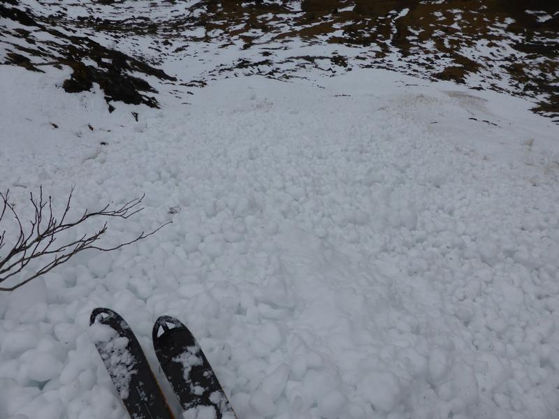
There's a running joke amongst climbers as to whether "Clova is in".  This is in reference to the relative scarcity of good winter climbing conditions, mostly due to the low altitude of the climbs here.  From a skiing point of view, good conditions are even more elusive, but they do exist!  The top of cliffs are only at 750m a.s.l., so good conditions are tricky to come by.  Snow bearing Southerly, or Southwesterly winds will fill the gullies, but you'll have to consider snow stability.   Needless to say, good conditions rarely hang around for long.

Approach

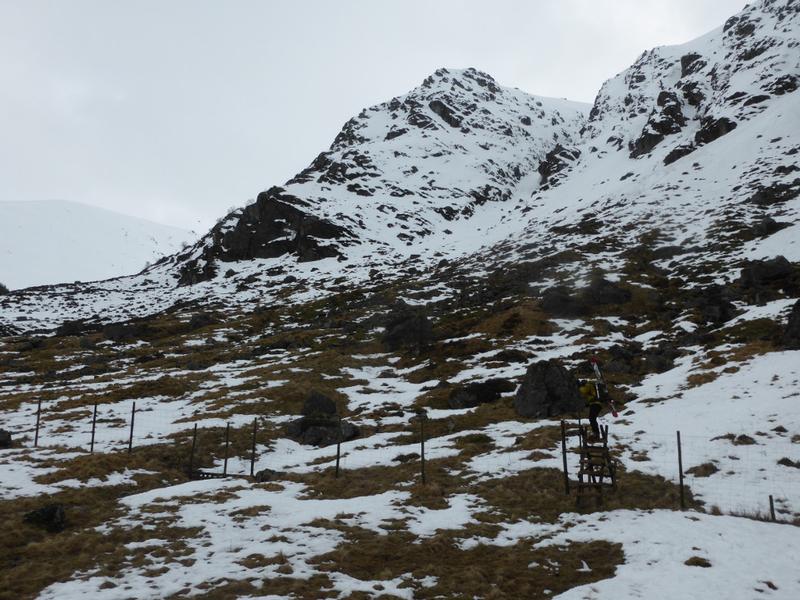
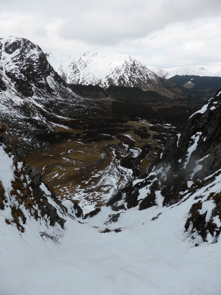
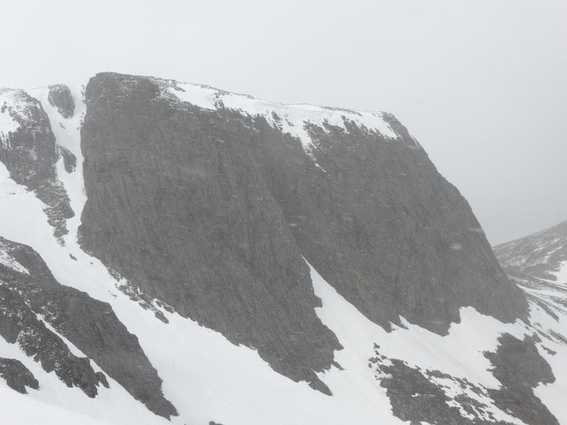
The shortest and most convenient approach is to park at the Ranger Station car park at the end of the Glen Clova road (Pay & Display).   Follow the partially waymarked forestry tracks towards Corrie Fee.  The track becomes a well maintained path for the last few hundred metres, bringing you into the corrie at the edge of the forest.  At just over 3km, and only 200m ascent to this point, you should be able to get into the corrie within the hour.  This provides a fine viewpoint of the corrie, and allows you to asses your options.

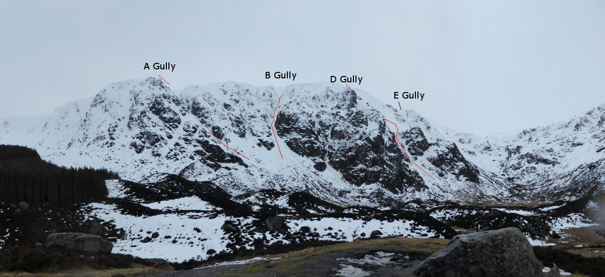
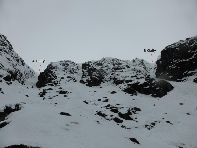
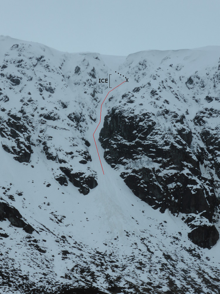
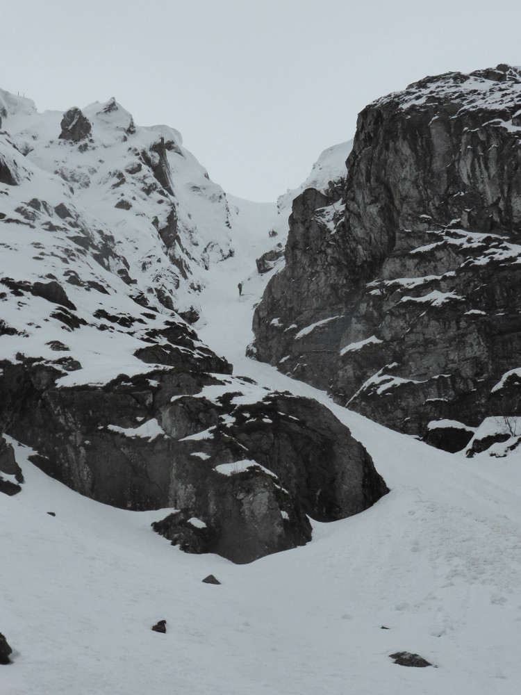
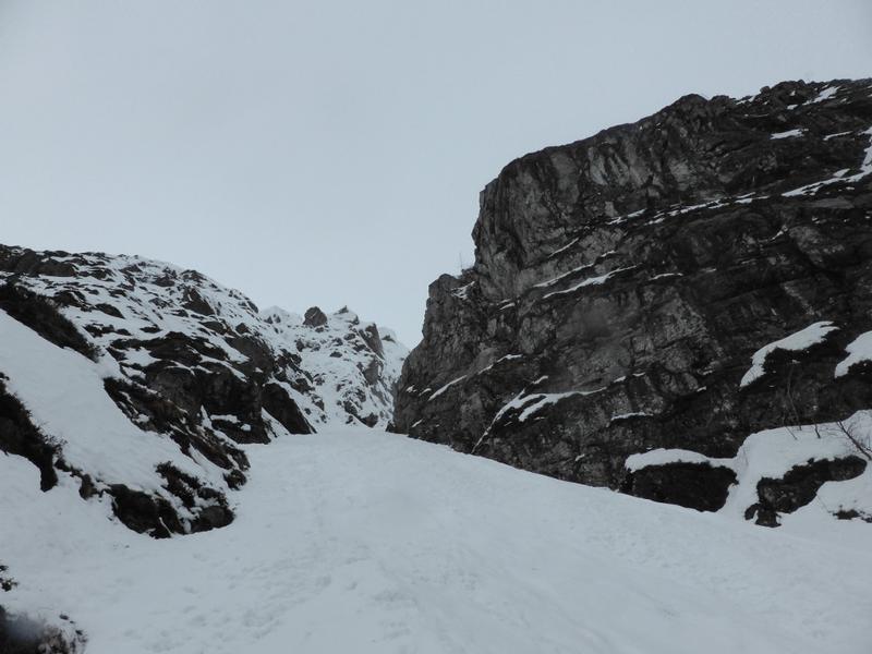
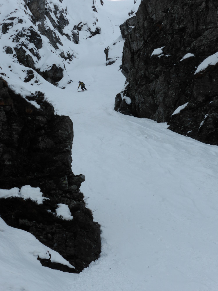
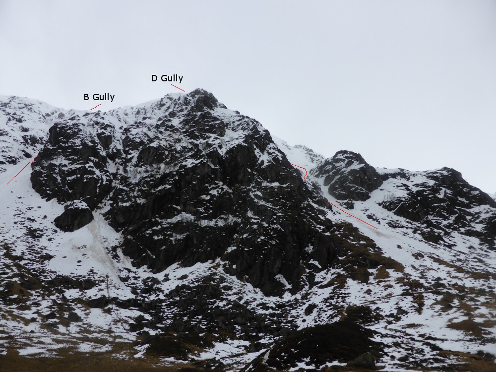
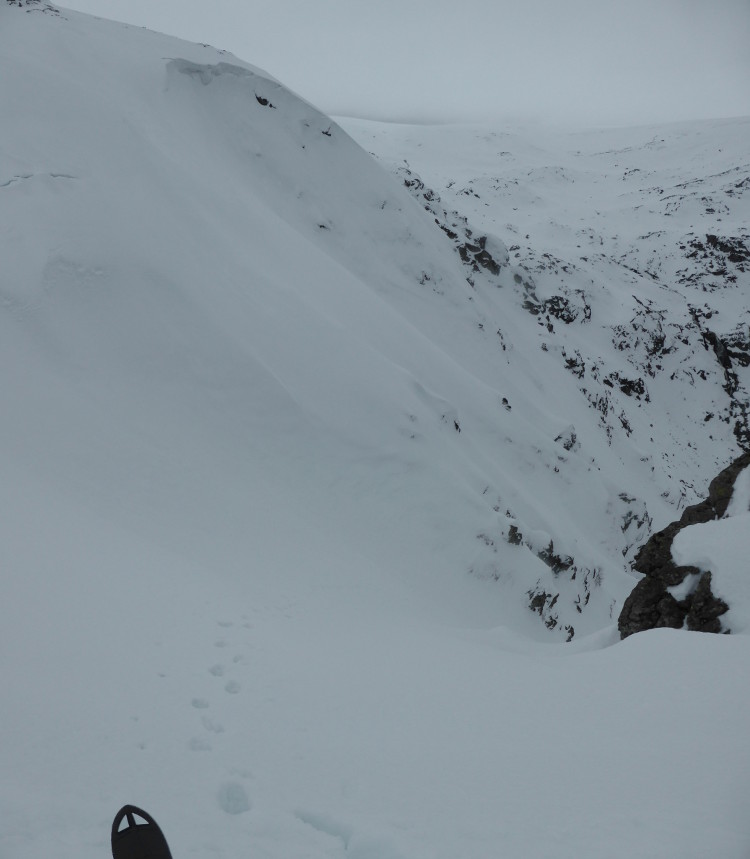
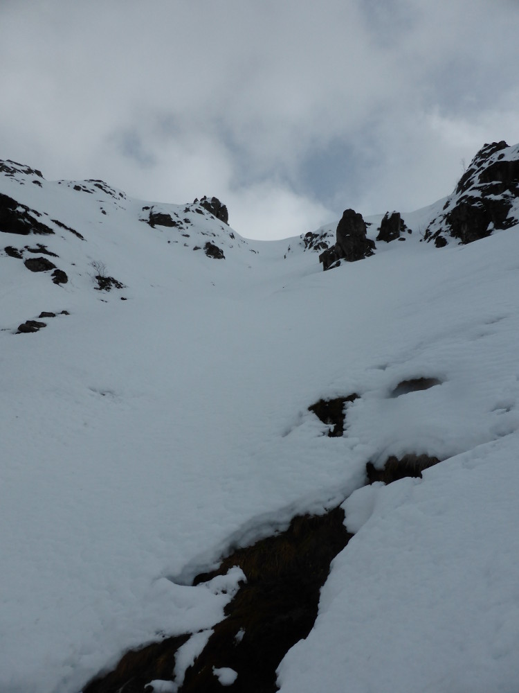
To access A Gully and B Gully, follow the path into the corrie, and then cross the stile over the deer fence.  To get to D Gully, keep following the path, and as it cuts across the base of the cliff, D Gully is up to your left.

Other possibilities

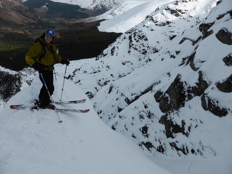
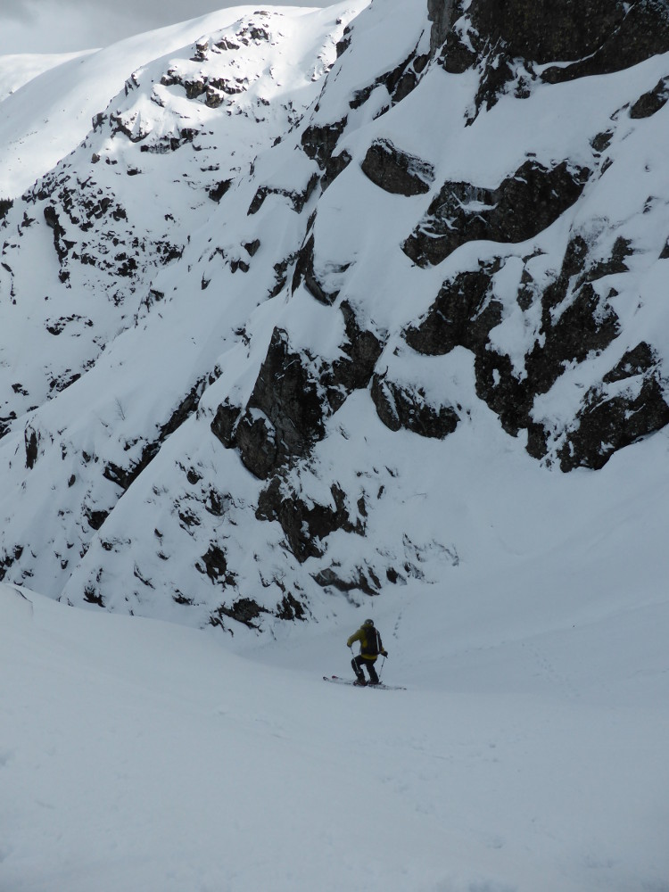
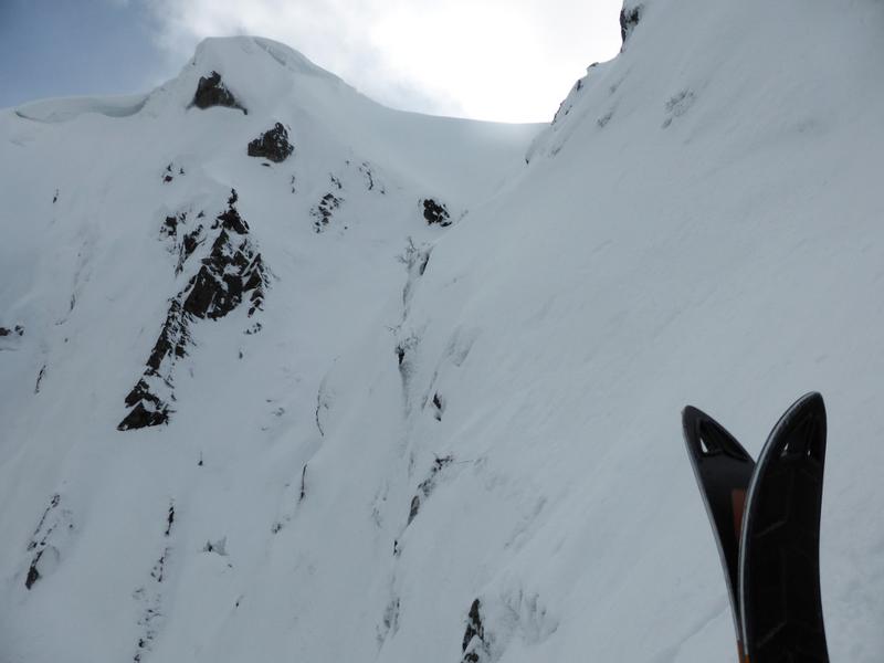
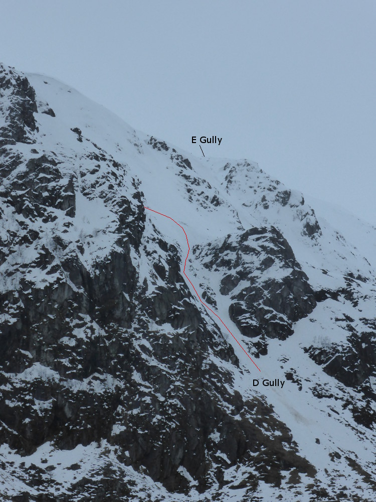
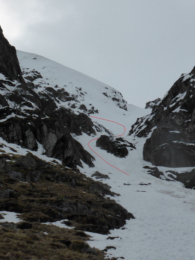
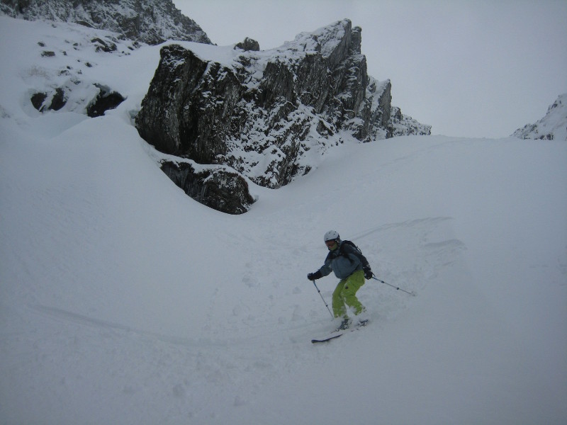
With the right snowcover, there are plenty of options in the vicinity of the corrie.   A descent of B Gully from the top is there for the brave to try in the right conditions, and E Gully looks like is could be worth a run.  There are a couple of South facing gully lines descending from Craig Rennet that look worthwhile, and Coire Sharroch has at least a couple of nice looking lines.  Out of the corrie, there are several possibilities on either side of Glen Doll, descending from Craig Maud and Craig Damff.   

Relevant Weather Forecasts

Met Office Logo
MWIS Logo

Relevant Avalanche Forecasts

There is one relevant Scottish Avalanche Information Service forecast for Corrie Fee, Mayar.

Hidden from view by A Gully Buttress once you exit the woods on the walk in, A Gully is an obvious target for skiing.  Perfectly straight, and near enough a uniform slope, it is an easy ski for Grade I.  It needs to be filled well to be skied though, as there are some sizeable boulders in the bed of the gully.  There is a small fork at the top, where it steepens slightly.  Either is straightforward.  It is clearly marked on the OS 1:50000 maps as the Eastern-most of the streamlines that descend into Corrie Fee from the plateau.

A Gully, February 2014  Photo: Scott Muir
About as steep as it gets in A Gully, and even this is avoidable.  Photo: Scott Muir
Below A Gully and B Gully  Photo: Scott Muir
Crossing the deer fence below A Gully and B Gully  Photo: Scott Muir
Skiing A Gully  Photo: Scott Muir
Grid Reference: NO252745

Approximate Start Height: 760m

Approximate Descent: 230m

General Aspect: North

Climbing Grade: I

Notes: Easy for the grade
 

B Gully is the deepest, most defined of the gullies, and is clearly visible on the walk in.  When full of snow, the gully looks like it would be a great ski from the top, but on closer inspection, you are likely to find a sizeable ice pitch 3/4 of the way up.  In lean conditions, when you wouldn't even consider a descent, the ice pitch can be over 10m high. It is recommended that you ascend the gully first, and even better, check it out from above as well having already climbed another line, e.g. A Gully.

In ascent, the gully twists slightly, and steepens as you approach the ice pitch.  To the right of the ice pitch, easy snow brings you to a small arete virtually level with the top of the ice pitch.  The inclusion of B Gully here describes a descent from this small arete.  If continuing to the top, a diagonal ramp leads back left above the ice pitch into the small upper bowl, and possible cornice.  The inclusion of B Gully here describes a descent from this small arete.  It may be possible to ski the diagonal ramp from the upper bowl, but that is for you to decide if it is worth the considerable risk for just a few metres of skiing.

From the arete, the steepest turns are at the top in the small bowl until you are well below the ice pitch.  The descent is steeper than A Gully, for example, but is uncomplicated with fine scenery.  It's not recommended that you become tempted by dropping to the skiers left of the arete instead.  The nice looking bowl funnels to a steep step!

Who knows, maybe there are conditions when the ice pitch near enough banks out...

B Gully from the entrance to the corrie, February 2014.  X marks the spot on the arete, with the black dotted line indicating a possible way to avoid the ice pitch.  Photo: Scott Muir
B Gully from below  Photo: Scott Muir
Below A Gully and B Gully  Photo: Scott Muir
Looking down into B Gully, on a day with no cornice (possibly collapsed within the previous 48 hours).  Photo: Scott Muir
Looking up from the entrance to B Gully  Photo: Scott Muir
On the arete.  Photo: Scott Muir
Skiing into the gully below the arete.  Photo: Scott Muir
Skiing the lower section of the gully  Photo: Scott Muir
The ice pitch to the left, and the diagonal ramp into the upper bowl, taken from the small arete.  Photo: Scott Muir
Grid Reference: NO249745

Approximate Start Height: 750m

Approximate Descent: 230m

General Aspect: North

Climbing Grade: II

Notes: The descent described only covers Grade I ground.
 

D Gully is well defined in it's lower reaches, but the upper section has several options.  In ascent, the main fall line bends to the left, and there are 2 shallow gully lines split by 2 fingers of rock.  The left most line is less likely to cornice than the line to the right of the fingers of rock due to the top being located on a small ridge, rather than being backed by the plateau.

In descent, the upper gully is comparable in angle to A Gully, but less defined.  As you approach the bend in the gully, be wary of following the fall line down a narrow chute, as it contains chockstones and a tree that may not be covered.  You should be able to check the condtition of this on the way up.  If this section is bare, you can cross a big slope on skiers left until above the line of the lower gully.   It's then a case of picking your way down, deciding upon which of the 2 branches in the lower section has the most snow.  This lower section is likely to be most affected by thaw, but again, it will be obvious in ascent as to what the cover is like.

There is also a direct option, starting to the skiers right of the shallow rib that separates D Gully from E Gully.

D Gully from the corrie floor  Photo: Scott Muir
Another view of the lower section of the gully from the corrie floor  Photo: Scott Muir
At the top of D Gully.  The alternative corniced shallow gully line is visible beyond.  Photo: Scott Muir
Looking down D Gully from the bend.  Photo: Scott Muir
Looking up D Gully from the bend.  Photo: Scott Muir
The lower reaches of D Gully  Photo: Scott Muir
what you may find you are skiing on after a thaw.  Photo: Scott Muir
Grid Reference: NO247747

Approximate Start Height: 740m

Approximate Descent: 200m

General Aspect: North, then Northeast

Climbing Grade: I

Notes: Straightforward if the correct branch is taken
 
Bookmark and Share
Mountain List
 
Latest News
Map updates
Updates to the mapping functionality
16-Oct-21
Overdue site content updates!
New pages and updates to the site, including Gleann Eanaich, Bla Bheinn and Beinn Alligin
07-Apr-21
 
 
Random Image
Site developed by Scott Muir
Site News   |   Disclaimer   |   Accessibility   |   Site Map   |   Cookie Information  
© Steep Scotland 2024