Steep Scotland
This site uses cookies to help understand how you and other visitors use the site. You can see a list of these cookies, and what they are used for, on the cookie information page.

By visiting any other page on this website, you are consenting to the use of cookies by this site. You will only see this message once, but will be able to set your preference at any time on the cookie information page.

Lochnagar: The Stuic

Lochnagar: The Stuic.   Photo: Scott Muir

Albeit of shorter stature than the great North-East corrie of Lochnagar, there are several short descents to be had either side of the imposing Stuic buttress.  Providing the snow is stable, the skiing here can have a slightly more friendly feeling than the main corrie.   

Approach

The most logical approach if you are only planning to ski in this corrie is to park at Keiloch (NO188913) , just to the North of the Invercauld Bridge.  Land rover tracks make their way through the Ballochbuie Forest, passing through 4 gates until you come out of the trees and end up at a small open pony shelter next to the Feindallacher Burn.

Assuming the lower ground is snow free, a bike is useful for this approach.  You can cycle as far as a small pony shelter at the end of the track (NO204874).  From there you can either follow the path up onto Carn an t-Saigairt Beag and traverse to the The Stuic, or take a more direct approach across boggy heathery ground.

The most direct route back to the plateau following a descent is to scramble up the buttress of The Stuic.  This can be awkward (if in ski boots and carrying skis).  Although only Grade I under winter conditions, it can be quite tricky if you are not familiar with some of the bypasses to steeper sections (mostly on the left).  If that doesn't suit, it's not far to either of the easy ascents at the West and East of the corrie.

Relevant Weather Forecasts

Met Office Logo
MWIS Logo
Mountain-forecast.com Logo

Relevant Avalanche Forecasts

There is one relevant Scottish Avalanche Information Service forecast for Lochnagar: The Stuic.

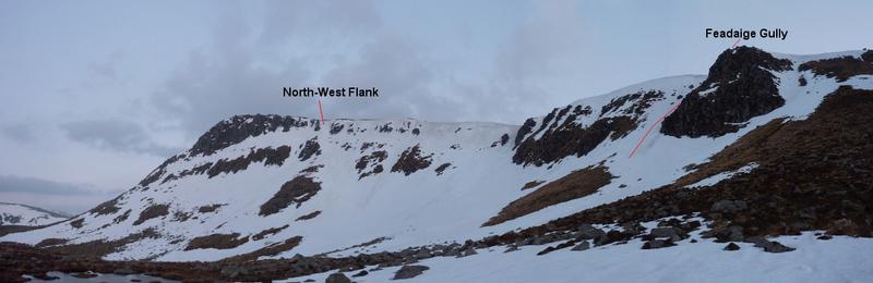
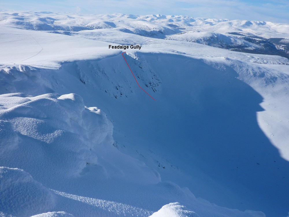
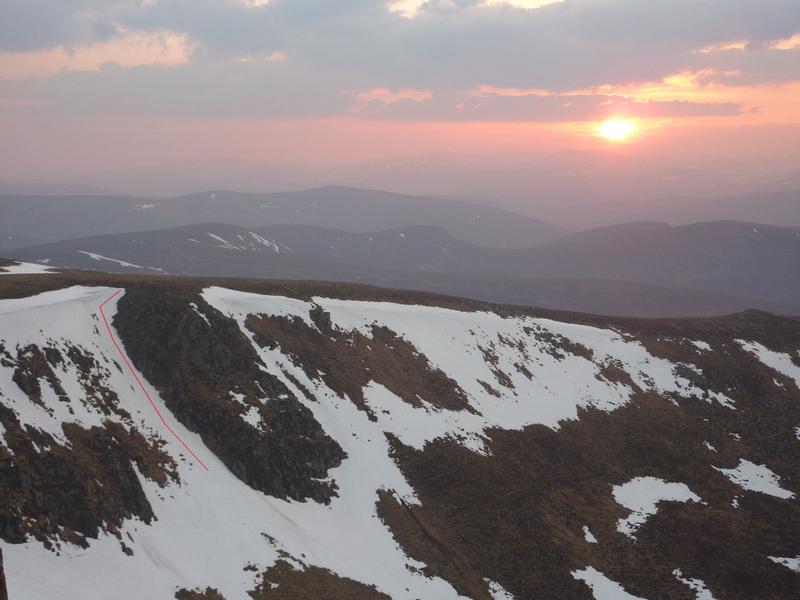
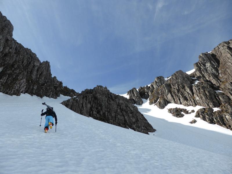
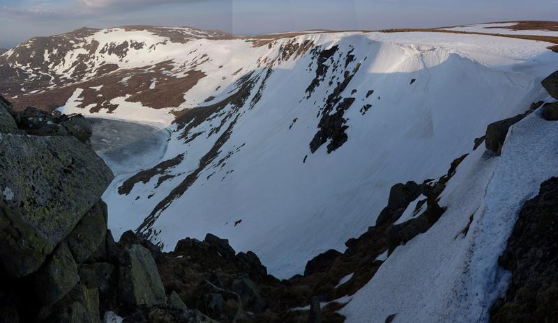
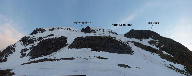
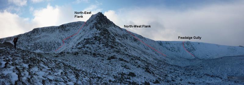
There are a couple of obvious options on this face, both with steep starts through the upper band of crags, and both finding a way through the lower crags.  The line described is the most gully like.  Start just a few metres to the South of the summit of The Stuic.  Traversing in from skiers left may be the best option to get in below the cornice.  The angle immediately relents, and you will find yourself on a big slope which appears to come to an edge.

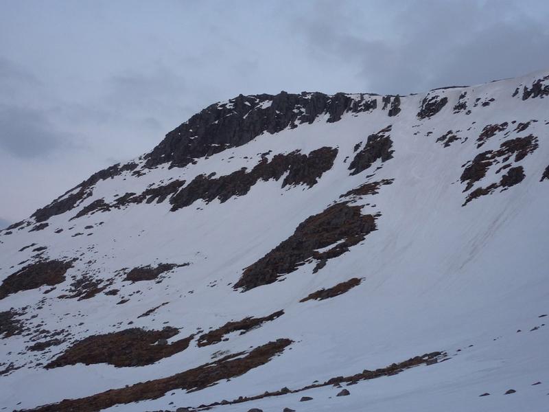
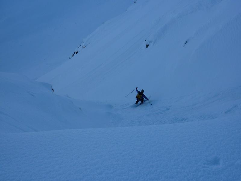
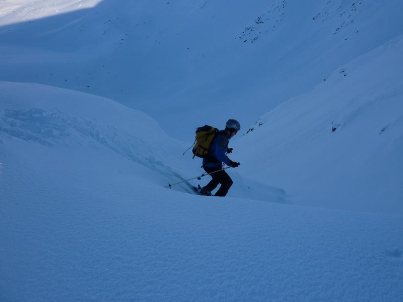
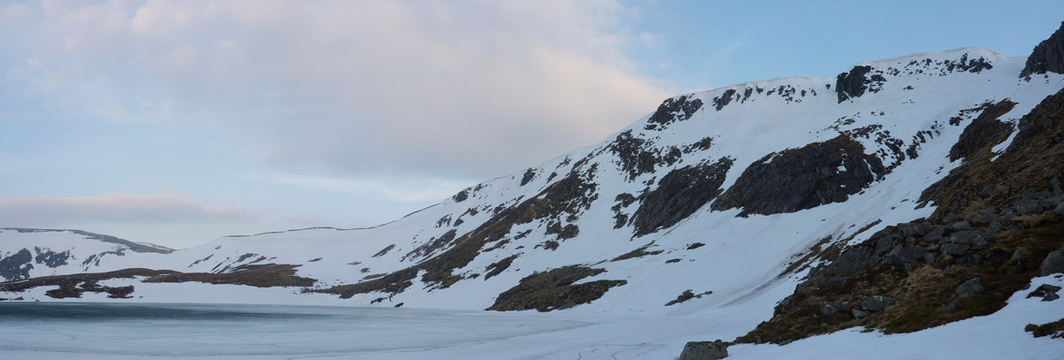
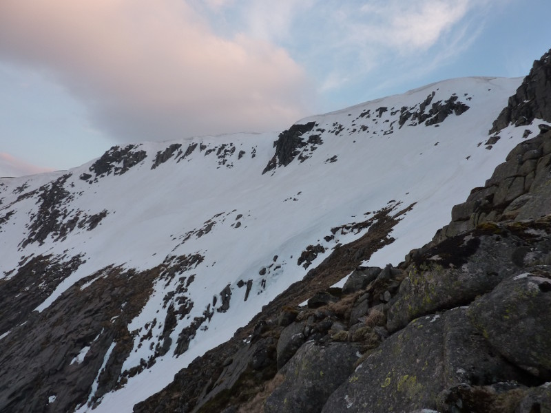
The edge is the lip of an awkward steep sided scoop about half way down.  It's worth scoping out the possible entry into this scoop from below if possible, as the entry is above steep craggy ground.  It appears that skiers right holds onto the snow the longest, and can offer the last way through the rocks.  It may well be that in good conditions, it's possible that a deviation is not required.  Once into the scoop, the descent is very easy all the way down to the loch.

The need for care in approaching the scoop means that it isn't as satisfying as other lines, but it's still a nice place to ski.

The line described is the shallow gully on the right.  Photo: Scott Muir
At the top of The Stuic, looking to the entrance of the North-East Flank.  Photo: Scott Muir
Looking back up the North-East Flank  Photo: Scott Muir
The North-East Flank from The Stuic buttress.  Photo: Scott Muir
Very early season view of The Stuic, but shows the location of the runs in relation to each other.  Photo: Scott Muir
Grid Reference: NO227852

Approximate Start Height: 1090m

Approximate Descent: 200m

General Aspect: Northeast

Climbing Grade: n/a

Notes: 2 short steep sections: right at the top, and entering the scoop. Otherwise easy angled.
 

Directly below the summit of The Stuic is a line of crags that are about 80m at their highest.  Heading West from the summit, they diminish in height until short snow gullies can be found to give access to the slopes below.  The line described descends the descent gully often used by climbers.   It is characterised by a rocky pinnacle on skiers left at the top ("Stegosaurus Rib").  The angle is considerably less than the companion North-East flank, and gives an excellent ski to the corrie floor, trending slightly left once out of the short entrance gully.

The North-West Flank of The Stuic from the West.  Photo: Scott Muir
A view of the entire NW Flank, showing the obvious other possible options.  Photo: Scott Muir
Looking back up the North-West Flank after a late evening descent.  Photo: Scott Muir
The start of the North-West Flank descent, with the prominent rib on the right.  Photo: Scott Muir
Very early season view of The Stuic, but shows the location of the runs in relation to each other.  Photo: Scott Muir
Grid Reference: NO224852

Approximate Start Height: 1050m

Approximate Descent: 200m

General Aspect: North

Climbing Grade: n/a

Notes: Would equate to a difficult red / easy black run.
 

This is a short gully to the West of the main summit.  It can provide a short easy introduction to gully skiing if in the area.  It is in reality a shallow runnel at a corner of the cliff line rather than a defined gully, but is worth doing if in the area anyway. 

I've labelled it "Feadaige Gully" for the sake of identification, as it is located in Coire Lochan na Feadaige.  The buttress on skiers left is called "Feadaige Buttress", so it seemed logical to use the name "Feadaige Gully".  There is another short, shallow gully on the other side of Feadaige Buttress.

Looking to the gully in February 2010.  Photo: Scott Muir
A late season view of the gully from the summit of The Stuic  Photo: Scott Muir
A view of the entire NW Flank, showing the obvious other possible options.  Photo: Scott Muir
Firm conditions in the gully, February 2010  Photo: Scott Muir
The entrance to the gully  Photo: Scott Muir
Very early season view of The Stuic, but shows the location of the runs in relation to each other.  Photo: Scott Muir
Grid Reference: NO222854

Approximate Start Height: 1000m

Approximate Descent: 120m

General Aspect: Northeast

Climbing Grade: n/a

Notes:
 
Bookmark and Share
Mountain List
 
Latest News
Map updates
Updates to the mapping functionality
16-Oct-21
Overdue site content updates!
New pages and updates to the site, including Gleann Eanaich, Bla Bheinn and Beinn Alligin
07-Apr-21
 
 
Random Image
Site developed by Scott Muir
Site News   |   Disclaimer   |   Accessibility   |   Site Map   |   Cookie Information  
© Steep Scotland 2024