Steep Scotland
This site uses cookies to help understand how you and other visitors use the site. You can see a list of these cookies, and what they are used for, on the cookie information page.

By visiting any other page on this website, you are consenting to the use of cookies by this site. You will only see this message once, but will be able to set your preference at any time on the cookie information page.

Lochnagar: North-East Corrie

Lochnagar: North-East Corrie.   Photo: Scott Muir

The grand Northeast corrie of Lochnagar is split into 2 distinct sections.  The main corrie has the obvious line of Black Spout, and it's Left Hand Branch, whereas the Southern Sector offers the possibility of many short steep descents.

Approach:

The easiest approach is from the car park in Glen Muick, following the landrover track and good path to the col below Meikle Pap.  From there, either head into the corrie, or ascend the good path through the boulders onto Cuidhe Crom.   There are many vantage points around the rim of the corrie to allow you to look down into the various lines.

If snow cover allows, on your return to the Glen Muick car park, it's not much of a detour to skin up just to the north of An t-Sron, and to descend one of the runnels of snow to the landrover track by the loch (e.g. NO291845).

Relevant Weather Forecasts

Met Office Logo
MWIS Logo
Mountain-forecast.com Logo

Relevant Avalanche Forecasts

There is one relevant Scottish Avalanche Information Service forecast for Lochnagar: North-East Corrie.

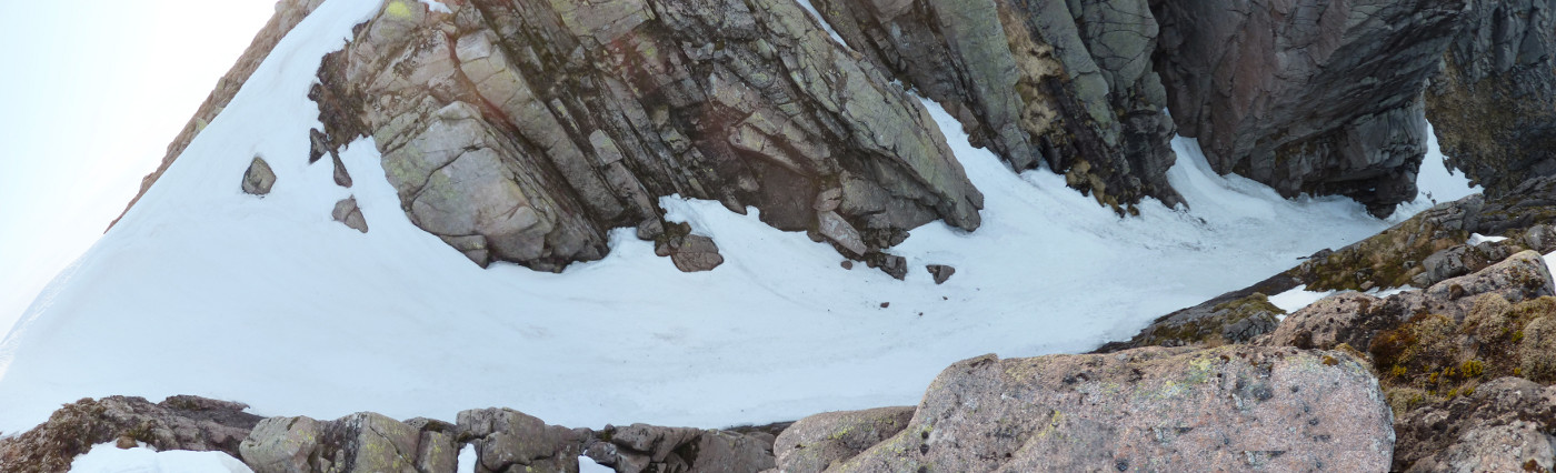
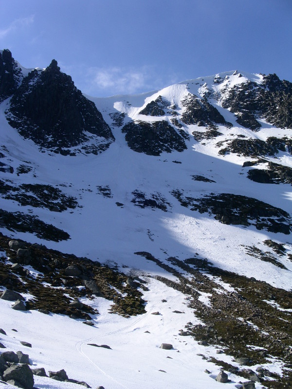
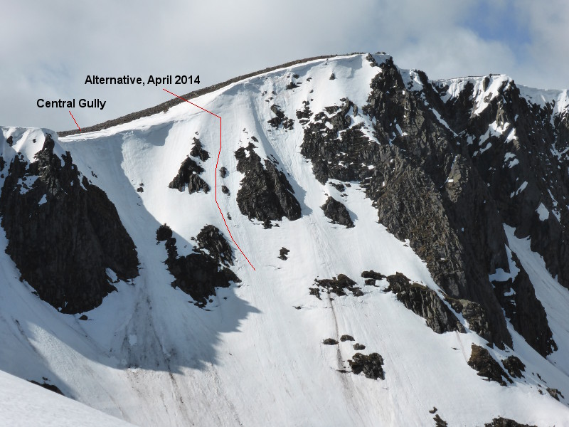
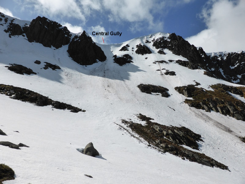
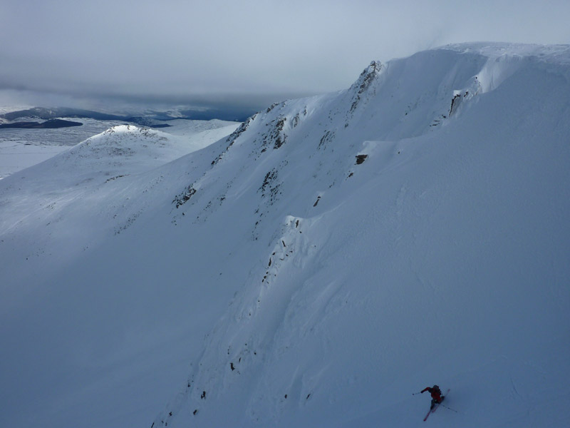
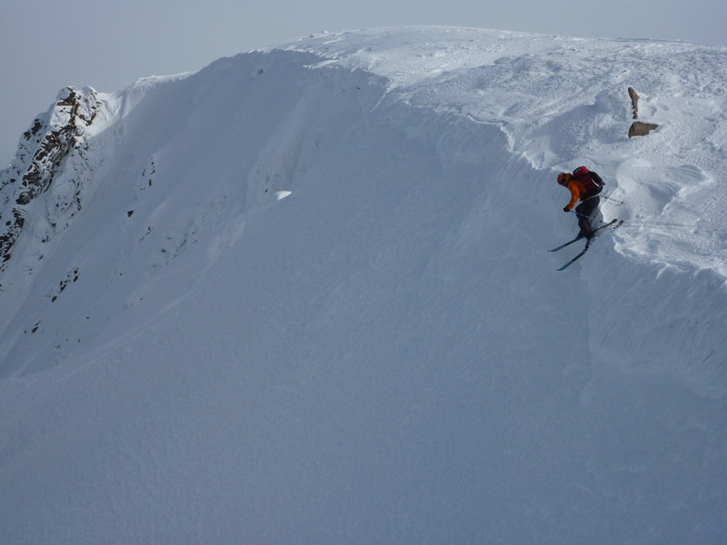
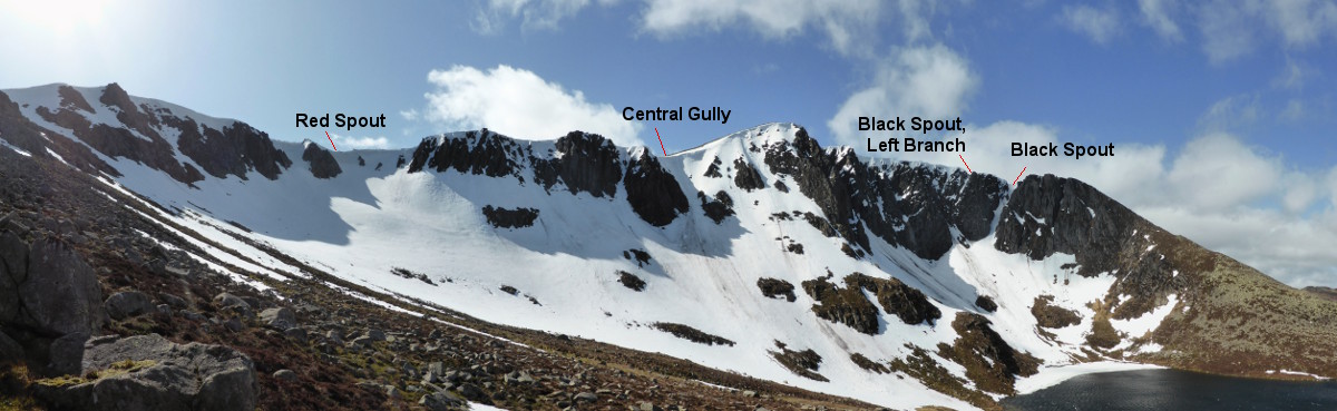
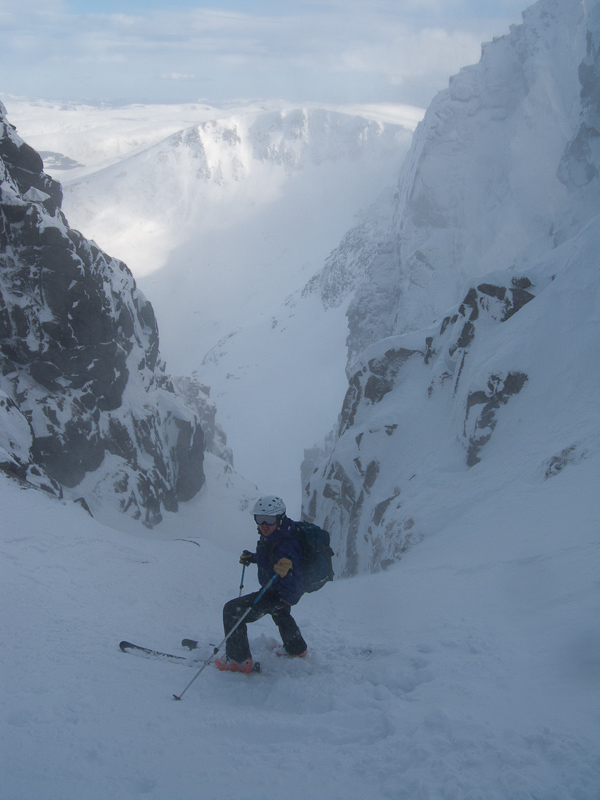
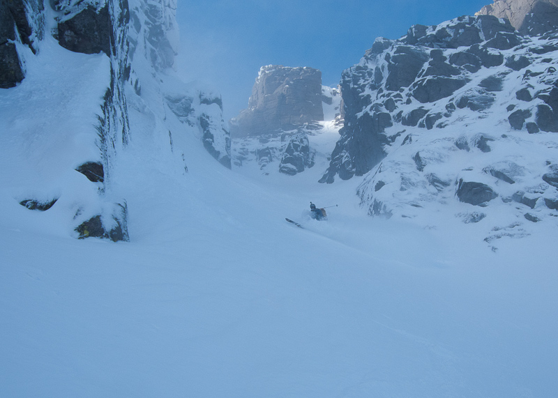
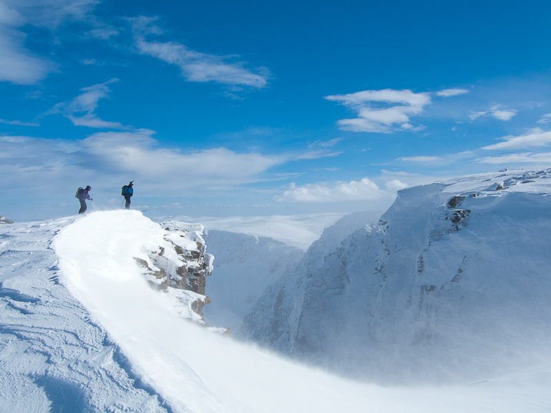
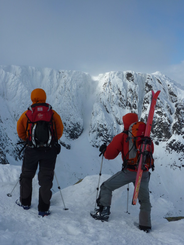
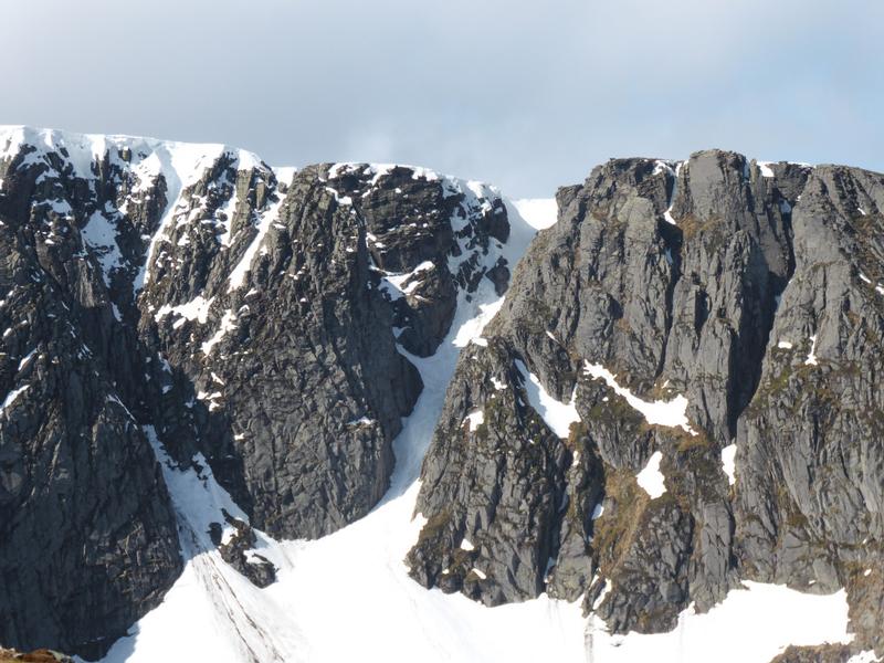
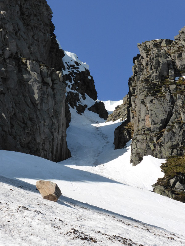
Without doubt, the most celebrated gully descent in the Northeast of Scotland!  The wide corridor of Black Spout is an obvious landmark in the corrie, cutting a deep line through the cliffs of Lochnagar. 

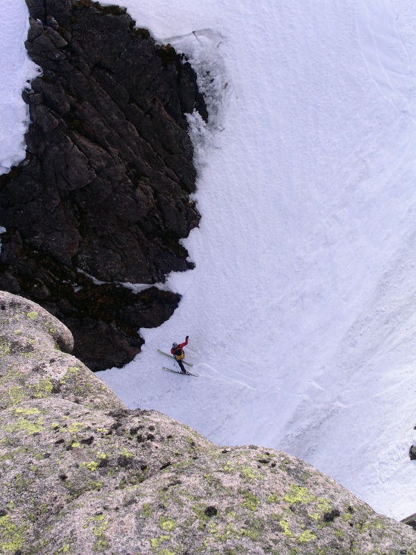
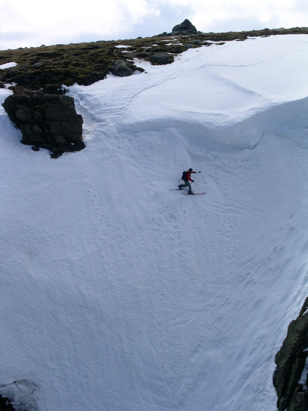
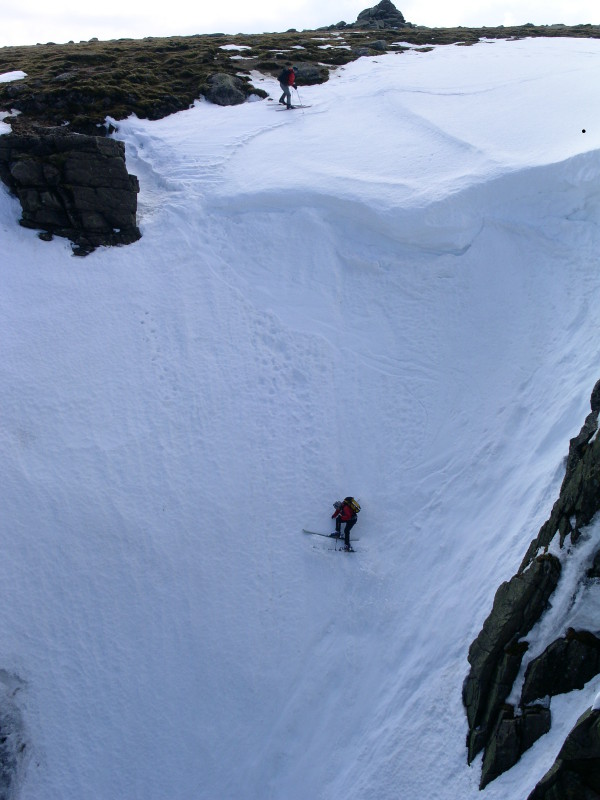
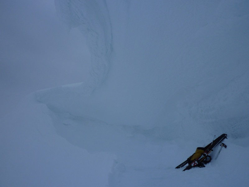
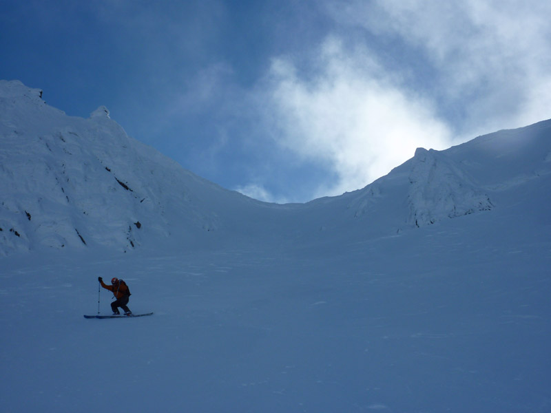
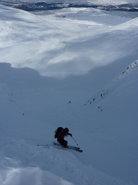
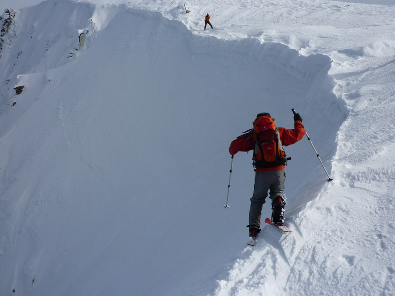
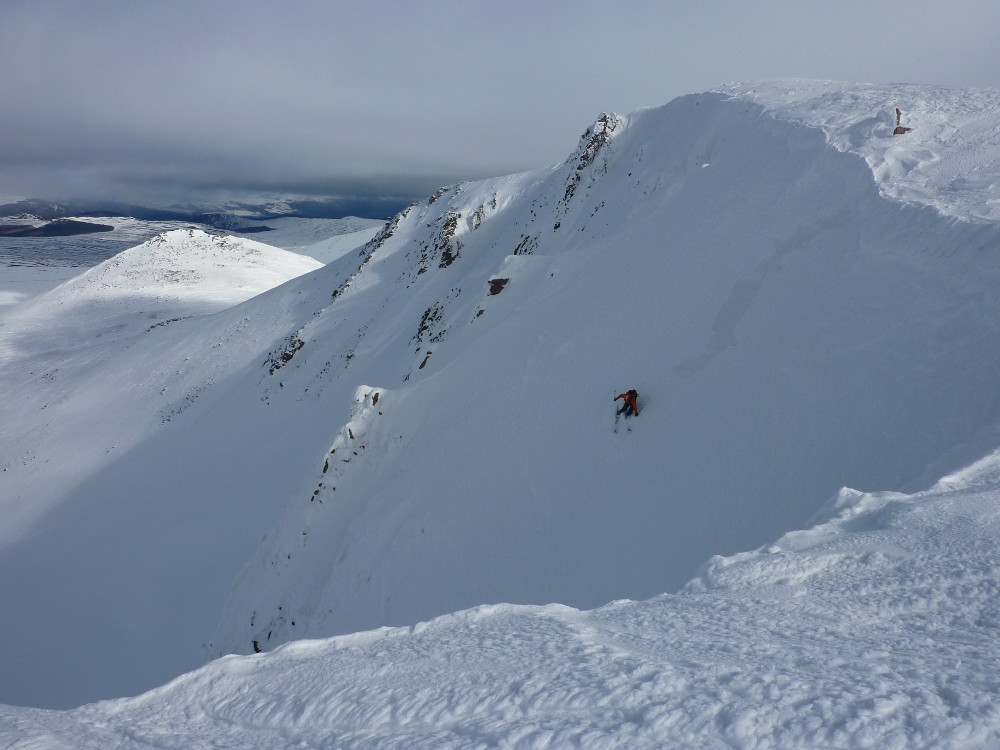
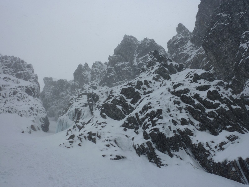
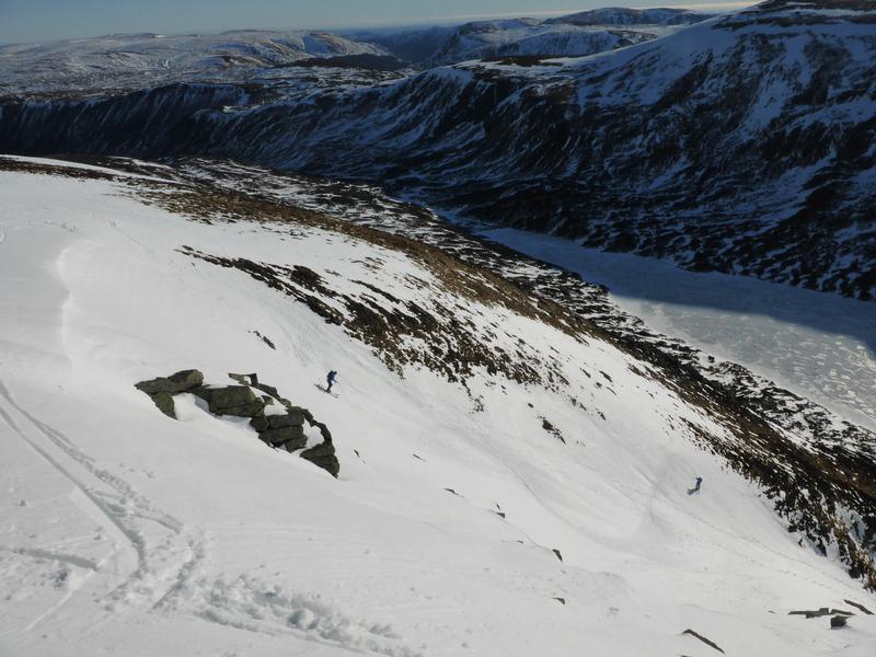
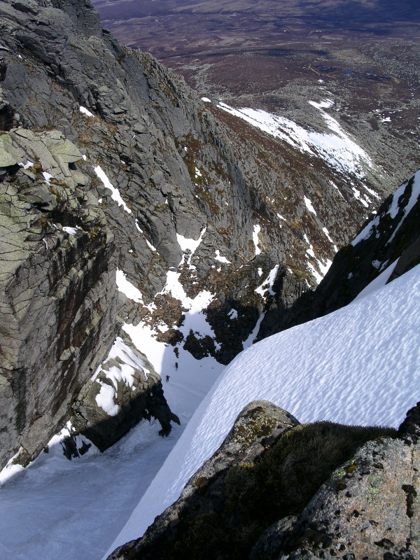
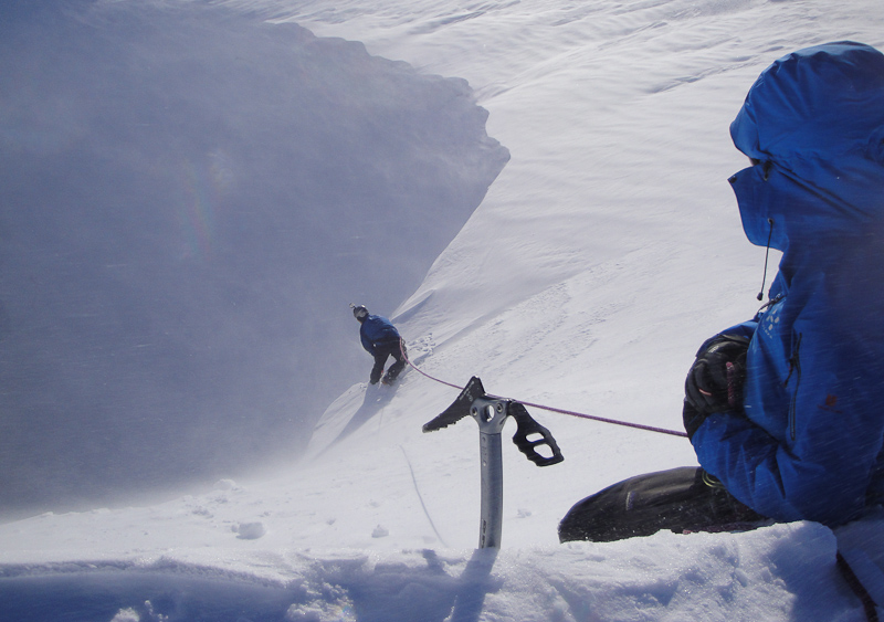
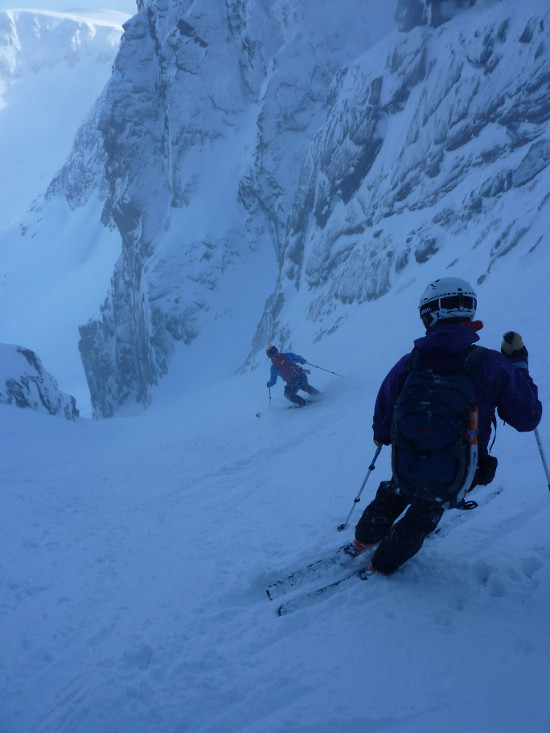
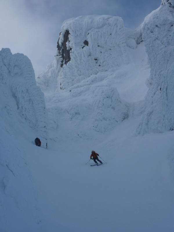
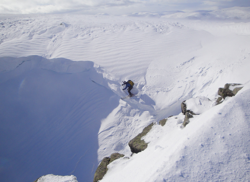
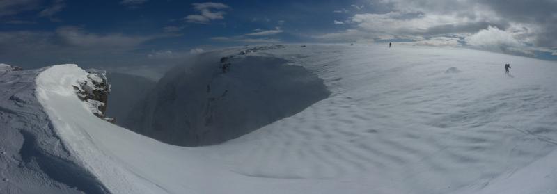
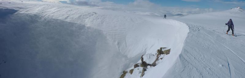
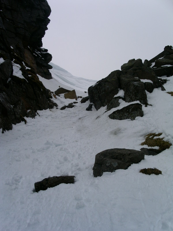
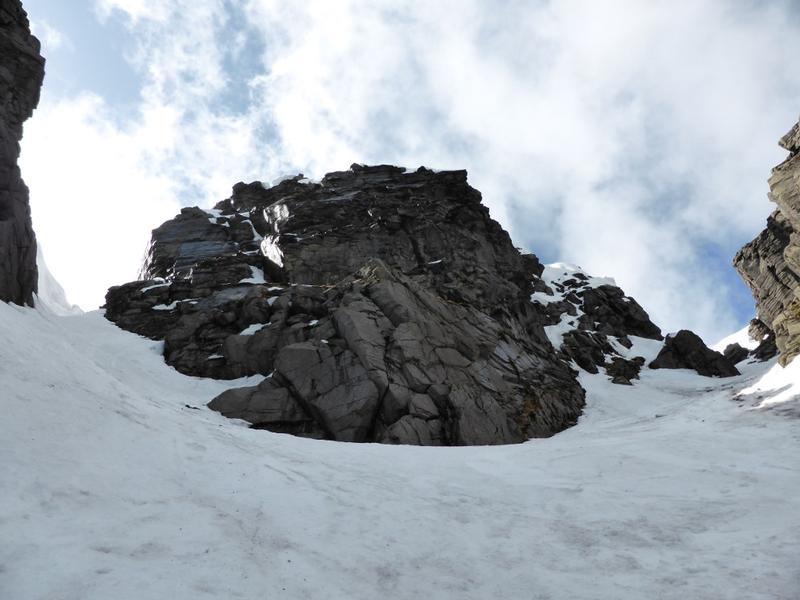
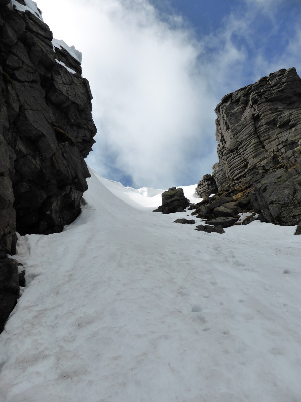
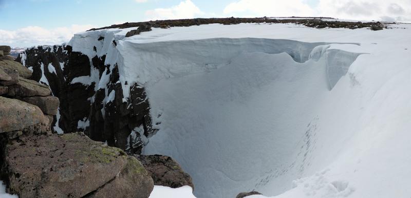
Ideal conditions will be stable snow following considerable snowfall on Southwesterly or Westerly winds.  The top of the gully can be heavily corniced, particularly skiers right.  The easiest entry is usually skiers left, where there may be a shallow runnel allowing access.  The upper section of the gully funnels into a narrow steep section.  This is the crux of the descent.  It's very short, and not that steep, but crucially, it can often be icy or bare.  Once beyond that section, the gully widens to the junction with the left hand branch.  There can often be a scoop in the snow here at the junction.  The lower section of the gully is wide and quite easy angled. 

Below the gully, you could continue all the way down to the loch, or if you wish to use your height to take out some of the distance across the corrie, stay high out of the bottom of  Black Spout, crossing the snow cone below Raeburns Gully and descend the far side of that, aiming for the cairn and rescue box.   From there you should be able to glide into the southern sector of the corrie.

It appears that Black Spout was skied from just below the cornice by Ashie Brebner... in 1954!  You can read about it on page 26 of Issue 61 of the Scottish Mountaineer magazine (November 2013).

At the junction with the main branch and the left hand branch of Black Spout  Photo: Scott Muir
Checking out the cornice.  Photo: Dave Smith
Good conditions in Black Spout  Photo: Dave Smith
In Black Spout  Photo: Scott Muir
In Black Spout, below the narrows.  Photo: Scott Muir
It was a soft landing in nice powder.  Photo: Dave Smith
Powder in Black Spout  Photo: Dave Smith
The mouth of Black Spout on a windy day.  Photo: Scott Muir
The narrows during a lean spell.  Photo: Scott Muir
The top of Black Spout, checking out the entry.  Photo: Dave Smith
Looking into Black Spout from Cuidhe Crom  Photo: Scott Muir
At the juntion between the branches in Black Spout  Photo: Scott Muir
Black Spout, April 2014  Photo: Scott Muir
Looking up Black Spout in very full condition, April 2014  Photo: Scott Muir
The narrows, completely buried.  April 2014  Photo: Scott Muir
The reliable skiers left entrance, April 2014  Photo: Scott Muir
Grid Reference: NO245858

Approximate Start Height: 1130m

Approximate Descent: 280m

General Aspect: East

Climbing Grade: I

Notes: The top third is the most difficult, with the lower two thirds being much easier.
 

The left hand branch of Black Spout is a more reliable option to the main branch in lean years, or late in the season.  When snow free, there is a sizeable chockstone with an amusing through route, but in winter, the volume of snow that piles into the gully means that you wouldn't know it was there.  It can often be the case that when the narrow section of the main branch is free of snow, the left hand branch is complete.

A good vantage point to peer into the gully can be found on the east side of the cornice, on a flat rock that protrudes from the side of the gully.  The main picture for the gully was taken from there.  There's sometimes enough snow in the gully for the cornice to obscure this rock!

At the junction with the main branch and the left hand branch of Black Spout  Photo: Scott Muir
In the Left Hand Branch of Black Spout  Photo: Scott Muir
Telemarking in the Left Hand Branch of Black Spout.  Photo: Scott Muir
The entry into the left hand branch of Black Spout  Photo: Scott Muir
A stitch of several images of the left hand branch of Black Spout  Photo: Scott Muir
At the juntion between the branches in Black Spout  Photo: Scott Muir
Grid Reference: NO245857

Approximate Start Height: 1140m

Approximate Descent: 290m

General Aspect: North, then East

Climbing Grade: I

Notes: Steepest section is at the top.
 

Central Gully marks the boundary between the main Northeast corrie and the "Southern Sector" (which in reality is more of an "Eastern Sector").  The gully is only really defined in it's lower reaches.   Towards the top it splits into a steep branch on the left, and a wide slope on the right that leads up onto Central Buttress. 

The easiest entry to the gully is likely to be on skiers right, although after a period of Southeasterlies, a sizeable cornice can form at this point, as you can see from the linked photo (February 2013).  In descent, it's steepest at the top, and the angle eases once into the lower defined section.  Be aware of snow conditions, as there are large avalanche prone slopes above the gully.

In April 2014, an alternative line was skied on the face between Central Gully, and Central Buttress.  This could prove a useful alternative when the cornice prohibits easy entry to the gully. 

Central Gully, between Central Buttress to the right, and Sinister Buttress to the left.  Photo: Scott Muir
What you might find at the top of the left branch of the gully after a period of Southeasterlies!  Photo: Scott Muir
Central Gully, and an alternative that was skied in April 2014  Photo: Scott Muir
Looking up Central Gully, April 2014  Photo: Scott Muir
Grid Reference: NO252854

Approximate Start Height: 1040m

Approximate Descent: 200m

General Aspect: North

Climbing Grade: I

Notes:
 

Red Spout marks the change in direction of the corrie rim, and can be a useful landmark in poor weather, as the red coloured gravel that gives the name to the feature is often exposed, even in winter.  However, when full of snow, Red Spout offers a short little warm up, possibly for Black Spout later in the day.  In full conditions, it's not much of a gully, and more of a slope below a cornice, but is worth doing.

There are plenty of other options in the area for ski descents.  An obvious slanting gully is the first feature found between the Meikle Pap col.  This is generally easier than Red Spout.  The skiers right of Red Spout is bounded by a triangular buttress.  To the skiers right of that again is a similar (but steeper) feature to Red Spout.

Getting the first turn in after the steep entry  Photo: Scott Muir
Looking back up Red Spout.  Photo: Scott Muir
Looking down Red Spout from a very firm cornice.  Photo: Scott Muir
Sliding into Red Spout  Photo: Scott Muir
Sliding into Red Spout.  Photo: Scott Muir
Entering Red Spout in 'firm' conditions.  Photo: Scott Muir
The 'Southern Sector', April 2014.  Red Spout is banked up to a slope. The 'Easy Gully' marked is a good short run into the corrie.  Photo: Scott Muir
Grid Reference: NO255853

Approximate Start Height: 1040m

Approximate Descent: 200m

General Aspect: North

Climbing Grade: I

Notes: Only steep for a short section at the top.
 
Bookmark and Share
Mountain List
 
Latest News
Map updates
Updates to the mapping functionality
16-Oct-21
Overdue site content updates!
New pages and updates to the site, including Gleann Eanaich, Bla Bheinn and Beinn Alligin
07-Apr-21
 
 
Random Image
Site developed by Scott Muir
Site News   |   Disclaimer   |   Accessibility   |   Site Map   |   Cookie Information  
© Steep Scotland 2024